Sunday, May 27, 2018

Reecer Creek Road


Reecer Creek Road heads north (with a few westerly jogs) across the broad slope above Ellensburg. When it hits the hills, it becomes Forest Road 35(00) and continues as a single lane paved road all the way up to Table Mountain.

Ellensburg is near 1500', the National Forest begins about 3000', and the pavement ends somewhere above 5600', which makes for quite a climb. Two bicyclists were working their way up the hill as I drove up  -- looked like a lot of work. I was glad to be in the car.

The upper section passes through the burn from the 2012 Table Mountain Fire. The landscape was still pretty stark, although there had been enough time for small trees to get started. It was amazing to me to see that there was a small enclave of homes near the top. Crazy place for residential construction - and it sure must complicate the fire management equation. Next thing you know people will be building homes on eroding cliffs in California and barrier islands on the Gulf Coast ...


Friday, May 25, 2018

Cle Elum


There are several routes between Ellensburg and Cle Elum. I've driven I-90 dozens of times, but rarely, if ever, taken any of the alternatives. Two of the routes began as railroads. One still is, while the other, the old Milwaukee line, is now called the Palouse to Cascades Trail (the John Wayne and/or the Iron Horse Trail until just last week). Several others are roads.

I rode from Ellensburg up to Cle Elum via Thorpe Prairie (a few different roads) and Upper Peoh Point Road, then returned via State Route 10, which winds down the Yakima Canyon. Someday, I'll come back and check out the rail trail or US 97, and maybe combine it with the Teanaway.

My turnaround, Pioneer Coffee, was also lunch and coffee and a chance to rest my legs. I thought about Dairy Queen, a frequent Cle Elum stop, but decided I didn't need it.

Thursday, May 24, 2018

Yellow Island


There are a lot of islands in the San Juans. Some are fairly large, like Orcas and San Juan, and are served by regular public ferries. Others are smaller and require residents to find their own passage - but this keeps them a bit more exclusive. And some are really small - sometimes just enough room for a big house, a boat house, and a few trees.

Fortunately, many of the islands are undeveloped. Some are state parks, some are part of a National Wildlife Refuge, and this one is owned by The Nature Conservancy. Technically, Yellow Island isn't really undeveloped, as there is an old cabin and an outbuilding or two that date back to the previous owners (the cabin is now used by the steward).

Periodic burning helps maintain the natural open meadows and the abundant wildflowers. During this visit, there was purple-blue camas, red-orange paintbrush, yellow buttercup, and a host of other stuff from serviceberry to sedums.


I think my favorite parts were the two little gravel tombolos at each end and the park-like setting, which meant that you could almost always see the water and other islands in the distance.

Yellow Island is one of The Nature Conservancy's longest held acquisitions in Washington. They were offering tours and I thought it would it be great chance to visit, and get a nice boat trip, too. M was busy grading papers, so I offered my extra spot to J, who despite her TNC connection, hadn't made it up here yet.

Phil, the steward for the last 18 years, is wrapping up his tenure and his replacement has just come on -- it was nice being there during this turnover.

TNC: Yellow Island
BLOG: Island Time on Yellow


Monday, May 21, 2018

Mima Mounds


Parts of the prairie landscape south of Olympia are bumpy - quite regularly so. Theories range from gophers to earthquakes to soil processes to wind and vegetation. The debate has kept some geologists busy and kept many others entertained for most of a century.

During the last ice age, the Puget Lobe reached almost this far south - suggesting some connection between the glacier and this landscape, although I don't think anyone thinks it was the ice itself. It's something about the dirt in this area of glacial outwash that lends itself to pimples.

It turns out Mima Mounds are not just found here; they also occur in a variety of other places around the world. In those places they're typically called something else and there are additional hypotheses. And then there all sorts of patterned ground (self-organization of soils in cold and/or arid regions) and bioturbation features that have similarities, but take on significantly different appearances.

I like the idea that they represent an emergent landscape process that happens when the right combination of plants, animals and soils are left alone for a few thousand years. Complexity leads to regularity.


Japanese Garden


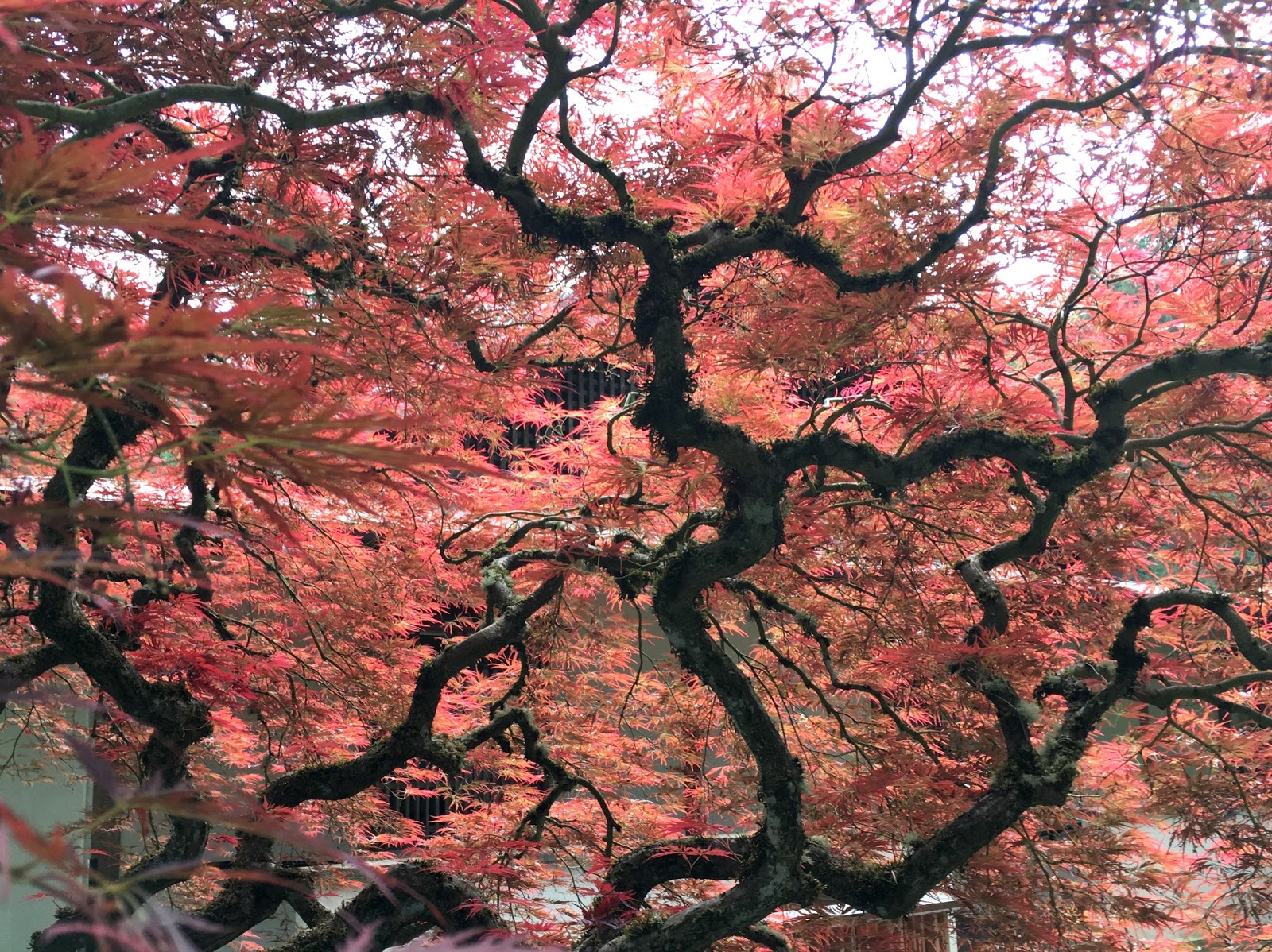
Portland's Japanese Garden is perched in the hills just west of town and the garden itself is topographically challenging. I think that sort of adds to its appeal, since it provides hiding places and surprise vistas.


Japanese Gardens appeal to me for the same reasons they do to many - the created landscapes, the structures, the water features, and the pathways. The trees and the flowers are great, but it's really more about story telling.


Northwest Portland


Portland, like any city, is more than just a downtown core. And I suspect we're like many tourists in recent years - we've found that the neighborhoods aren't just for locals. The locals, I suppose, see this as a mixed blessing.

I'm sure it's been aided by the spread of great restaurants to less traveled parts of town, the growth of short-term rentals and small boutique hotels, and ultimately, the internet. Which makes finding these places much easier and less uncertain.

This is the second year we've stayed in the northwest part of Portland. It's not that we didn't explore other neighborhoods by car and transit, but it was nice making our base somewhere other than downtown. 23rd is thriving. And the old industrial Slabtown area is sprouting housing and restaurants. We stay right on the street car line, so it's easy to get around, even into downtown if we want.

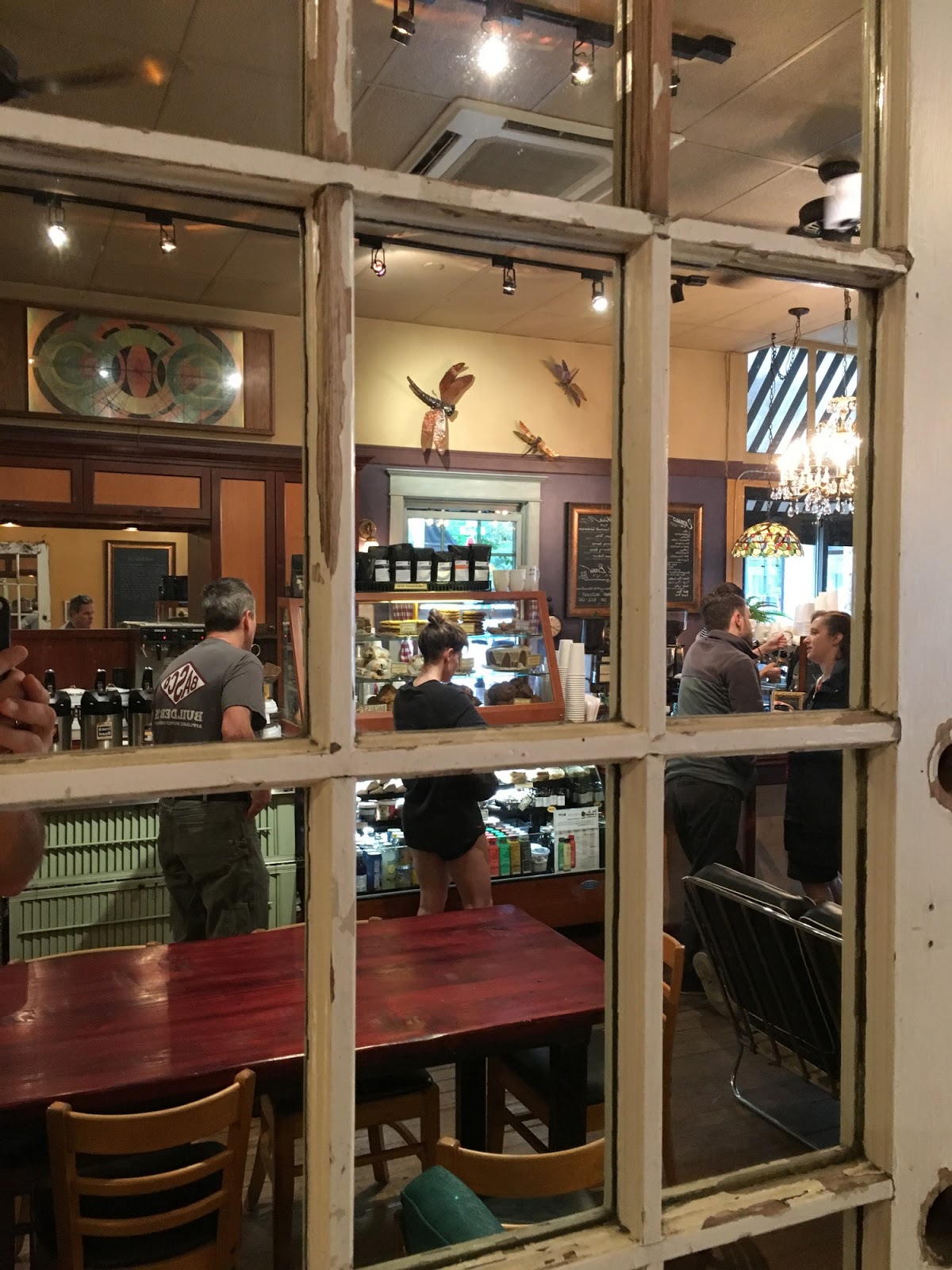
One of my favorite spots is the Dragonfly Coffee House. Good coffee, great atmosphere, and a sense that I'm visiting someone else's neighborhood, but that they don't seem to mind.

I associate this place with Ursula Le Guin, who had contributed to a neighborhood history that I found on a table here last year -- I guess she was part of this neighborhood. Maybe that's what had prompted me to reread Left Hand of Darkness this past January - which I was just finishing when she died.  I'm not sure if there's a connection or not, but "Dragonfly" is also a reference to a Tale of Earthsea.


Tuesday, May 15, 2018

Beacon Rock


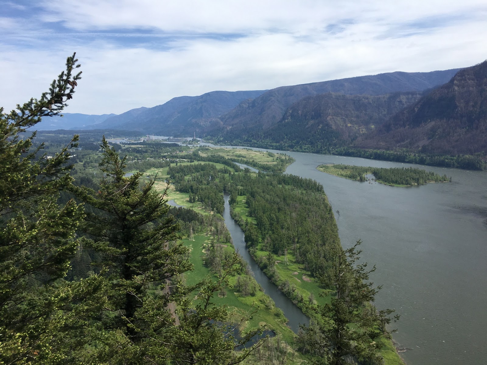
Beacon Rock is an 800' rock monolith standing on the north bank of the Columbia just downstream of Bonneville Dam. It's also a State Park and there is an amazing trail that zigzags its way up to the top.

We had detoured east from the I-5 Corridor to visit the Columbia Gorge on our way down to Portland - it was the first time in a very long time (maybe ever?) that we had driven the Washington side of the river through this section. After Beacon Rock, we passed the dam and crossed the Bridge of the Gods to Oregon. Where most slopes were charred from last year's fires.

The gorge is carved through Columbia River Basalts, which flowed this way to reach the sea before much of the modern Cascades formed. The lava flows are many millions of years old, whereas Beacon Rock is a basalt plug that formed the core of a small volcano a little more than 50,000 years ago. Very different stories.


This section of the Columbia Gorge has a rich geologic history. Besides its volcanic features, the canyon is significant in that the Columbia is the only river between the Fraser and the Klamath that cuts through the Cascade Range, which otherwise forms a stark drainage divide between the damp coast and the dry interior. At the end of the last ice age (less than 20,000 years ago), as many as 100 catastrophic floods rushed through the Gorge as Lake Missoula repeatedly emptied out from behind its ice dam in northern Idaho. And then, just a few hundred years ago, a huge landslide occurred on this side of the river just above Bonneville, pushing the river to the south side of valley. Interestingly, the dam right is built right at the toe of this large slide.


Thursday, May 10, 2018

Cama Beach

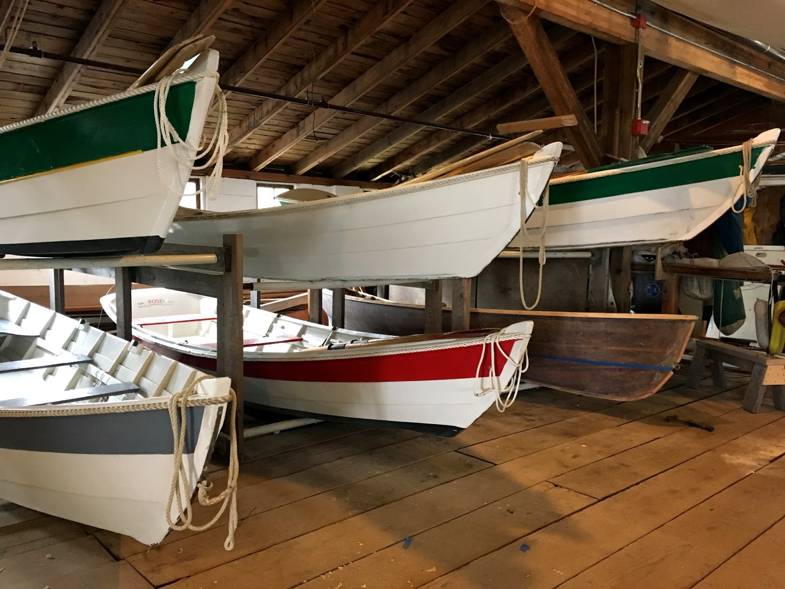
There's no one place on Puget Sound I seem to come back to more often than Cama Beach. It's convenient - not too far and no ferry. I've been involved with the place in a number of ways, both through work and on my own. And the more I get to know it, the more I enjoy coming back. This year I've been here with colleagues, with classes of adults, and with a bunch of high schoolers, and usually for work. This time, I had come up to the island to help with a workshop in the morning, but now I was on my own time.


The weather was far from ideal, but there was plenty of activity. Both among the guests and the volunteers down at the Center for Wooden Boats. I wandered down the beach to check out a couple of new landslides, along with a couple of old ones. But then came back to the boathouse. I love working with wood, but I find it easier to stick to straight lines and safer to stick to projects that can't sink. I suppose I could try to learn.


Yakima Canyon


After my trip to Steamboat Rock in 2011, I vowed to try to make a day trip east of the Cascades every spring. The weather isn't as hot and the hills are still a little green. But there's always something else to do or somewhere else to go. Last year I finally got back for a wonderful day in May to Frenchman and Potholes Coulees.

The Yakima River cuts through Umtanum Ridge between Ellensburg and Yakima. Canyon Road and a rail line follow the river, while I-84 takes a somewhat more direct, but awfully ambitious, route up and over the high ridge a little farther east. On a weekday morning, the traffic wasn't too bad and the weather was neither too hot nor too windy.


I parked the car at a BLM site on the river just upstream of the Roza Dam and rode upstream 18-19 miles until I cleared the north end of the canyon before turning around and heading back down. There's one tough hill in the middle where the road cuts off a bend in the river, requiring it to climb up and over a basalt spur, but overall it wasn't bad.


Wednesday, May 09, 2018

Whidbey Island


It was the first of two Saturday workshops - this one on Whidbey, next week's on Camano. I was able to swing by a potential restoration project on the way up - tough work on a day like this. The workshop went well and it was over by early afternoon. Once things were all wrapped up, I headed for a nearby park where I unloaded my bike and changed clothes.

The weather was a little grayer on the north end of the island and there was a cool breeze coming off the Strait, but it was good riding and I got to check out a bunch of my favorite island roads and beaches in a new way. The bike helps you discover hills you never really appreciated when in the car, but it made for a great 40-mile ride.