Showing posts with label National Park. Show all posts
Sunday, September 24, 2017
Promontory Point
In the spring of 1869, the Central Pacific was building east, the Union Pacific was building west, and I guess it was pretty clear they were going to meet somewhere in northern Utah. They both had built railroad grade well past the other - creating parallel roadbed for 250 miles from Wells, Nevada, to Echo Summit, Utah. Each was laying track as fast on the new roadbed as it could. On May 10th, they connected their track work at the summit north of Promontory Point, completing the first transcontinental railroad in North America.
I had been more focused on getting out to the Spiral Jetty, so we didn't spend much time at the Golden Spike Historic Site. We did catch the tail end of a staged reenactment of the ceremony, although I wish they could have had the whole scene recreated, including the face to face steam locomotives. But they keep those safely tucked away in a nearby engine house -- I suspect they still bring them out for special occasions.
The twin rail grades wind down the hill to the east. Neither has any track as the railroad long ago shifted its route farther south, skirting the southern tip of Promontory Point, and across the Great Salt Lake itself. But the 19th century hand-built grades present a technological contrast to the massive Orbital ATK Aerospace complex, which sprawls across the desert mountainside above the old railroad
I guess this is where they test rocket engines and other propulsion systems. Orbital ATK, which was just acquired by Northrop Grumman, builds rockets, missiles, satellite components, and apparently an awful lot of regular ammunition, too. Sort of your ultimate arms merchant - defense contractor. Unfortunately, I don't have any shots of their complex and the old railroad lines running by it, but the facility shows up well on Google Earth - the railroad a little less so.
Labels:
National Park,
roadtrip2017,
utah
Location:
22000 W Rd, Corinne, UT 84307, USA
Saturday, September 23, 2017
Bryce Canyon
Originally, Bryce wasn't on the itinerary. Leaving Boulder, we had three days to get back to Seattle and I figured maybe we would have to start driving northwest, not farther south. But at breakfast, we decided it didn't make that much difference and that Bryce would be worth a few extra miles. Plus, I wanted to drive that road south to Escalante anyway.
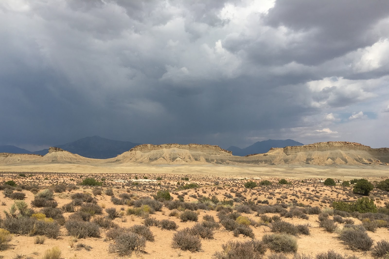
Dark clouds and rain threatened, and I guess there were a few drops, but when the sun came out, Bryce just lit up. There were crowds - no surprise. The tour buses and the guide books routinely include Zion and Bryce - which is one thing that makes Capital Reef and Grand Staircase-Escalante a little less crazy.
Bryce Canyon is a bit of a misnomer - since it's sort of a one-sided canyon. The bulk of the red rock hoodoos are around the edge of large bowls in the side of a high ridge. I think this might be better referred to around here as a break (as in Cedar Breaks National Monument, nearby), although the Visitor's Center also referred to the bowls as amphitheaters. But whatever you call it, the red and orange and white sedimentary rocks of the Claron Formation (old lake beds - limestones, silts, sands) weather to form a fantastic landscape of pinnacles and fins and narrow slot canyons.
The Colorado Plateau is basically a thick stack of rock layers - these are pretty much at the top of the stack. The precambrian metamorphic rocks at the bottom of the Grand Canyon are the basement. Zion and Capitol Reef and Canyonlands are all in the middle.
Labels:
National Park,
roadtrip2017,
utah
Location:
UT-63, Bryce, UT 84764, USA
Boulder UT
Boulder (a couple hundred people and a sharp bend in Utah Hwy 12) is located between the Aquarius Plateau on the west and the canyon country to the east. It and Escalante to the south are caught in the political battles between folks wanting more federal management in this region and those wanting less. Both towns are capitalizing on outdoor recreation and a lot more tourists looking for alternatives to the traditional suite of National Parks in southern Utah, but there are also those who believe that more traditional resource based industries would be better for the local communities (or simply begrudge outside "control" over their lands).
The Boulder Mountain Lodge was a nice contrast to the isolation of the lower parts of the Burr Trail. It would have been nice to hang out longer, but a bit pricey, too. The next morning, I rode my bike several miles back down the Burr Trail. Pretty much had it to myself. And added yet another wonderful sunrise bike ride to my trip's highlights. Breakfast, and dinner the night before, were at the Hell's Backbone Grill.
The road from Boulder to Escalante is one of the country's most touted scenic byways. For good reason. And freshly repaved, too! And at the bottom of the hill, where the road crosses the Escalante, there's the Kiva Koffeehouse. Nice morning.
Labels:
National Park,
roadtrip2017,
utah
Location:
Boulder, UT 84716, USA
Burr Trail
The Burr Trail winds its way up from Glen Canyon (Lake Powell) to Boulder through Utah's southern canyon country and what is now the southern portion of Capital Reef National Park and northern portions of Grand Staircase-Escalante NM.
It began as a cattle trail, but is now a relatively good, albeit lightly traveled road. A central section remains unpaved, including its famous switchbacks up through the Waterpocket Fold, but with the Subaru's clearance and dry weather was no problem. The paved sections are fine - though they cross a couple of low washes where heavy rains might present a challenge (and a danger).
The whole road is very isolated, however, so I was glad we'd fixed the slow leak in the tire while back in Taos. We passed only two cars in the first fifty miles or so - a few more when we got back to the paved section nearer to Boulder itself. Of course, as we headed away from the Lake, we noticed the AC was fading in and out. Not a big deal in itself - the temperatures were cooling as we climbed anyway - but I learned two weeks later back in Seattle, it was a secondary consequence of the engine cooling fans having given out -- glad I didn't realize that at the time!
Labels:
National Park,
roadtrip2017,
utah
Location:
Burr Trail Rd, Torrey, UT 84775, USA
Lake Powell
Our route across southern Utah took us from Blanding, west to Natural Bridges National Monument, and then on UT 276 down to Hall's Crossing on Lake Powell. The temperatures rose as we dropped down to lake level (below 4000' and the first time we'd been anywhere this near sea level since somewhere in western Nebraska). It was well into the 90s at the lake.
We lined up (with two other cars and two motorcycles) on the big paved ramp and got on the 2PM boat. It's a 30-minute crossing to Bullfrog and the westward continuation of UT 276. We stopped at the marina and I walked out and picked up some more water and drinks at the store, anticipating the long, isolated drive we still had in front of us that afternoon. It was partly the heat and partly the remote location, but there was something sort of surreal about the Bullfrog Marina. A little hub of activity, all centered on houseboats and jet skis and other pleasure craft, on a floating terminal in the middle of the desert.
The ferry's not a big one, but certainly far too big to pull in on a trailer. I assume they must have had to assemble it down here - it's not like they could sail it in from some shipyard somewhere.
Labels:
National Park,
roadtrip2017,
utah
Location:
Halls Crossing, UT 84533, USA
Friday, September 22, 2017
Mesa Verde
We spent two nights at the Far View Lodge inside the Park, which made our sightseeing easier and gave us a little more time to decompress - the drive in and out of the park is great, but winding and long. I didn't want to have to do it more than once each direction. The Lodge was fine, although these Park concessionaire operations always leave a little to be desired. Ditto with the dining room and the cafeteria.
The highlight was the cliff dwellings, as it should be. We headed down early and signed up for back to back walking tours of both the Cliff Palace and Balcony House. Which were great. They require a little dexterity - big ladders and small openings - but nothing we couldn't handle.
Labels:
colorado,
National Park,
roadtrip2017
Thursday, September 21, 2017
Black Canyon of the Gunnison
It's only 15 miles or so in a straight line from Lake City over to Ouray and Silverton. A little bit farther if you drive your ATV over Engineer or Cinnamon Pass. But much farther if you have to drive around by way of Montrose, which we did. On the other hand, the drive down the Lake Fork was beautiful and despite some concerned looks from my copilot, took the Blue Mesa cutoff over to US 50. It probably saved some miles; it may have saved some time.
Taking the long way around gave us an excuse to visit the Black Canyon - not that we should have needed one. The best thing about this canyon is that it really looks like what a canyon should look like. Deep, vertical, sort of scary. And the rocks are beautiful, too.
Labels:
colorado,
National Park,
roadtrip2017
Location:
Rim Drive Rd, Montrose, CO 81401, USA
Saturday, August 26, 2017
Glacier Park
A forest fire burning above Lake McDonald made our trip over the Going to the Sun Highway a little eerie. Traffic and construction gave us more time to take it all out in. But we eventually made it to Logan Pass, where parking was sort of like Friday evening in Ballard. But fifteen minutes of hovering paid off - though we didn't spend much more time than that walking around the visitors center.
The smoke was drifting over the divide and down into the St. Mary Valley and seemed to be getting worse while we watched. We stopped for the requisite photos on the way down - and left some of the smoke behind. Since our last visit (September 2012), much of the north shore of St. Mary Lake has burned (in July 2015). And the pullout at the Wild Goose Island overlook has been expanded - which meant we had to wait for three loads of tourists to get back into their little red buses before we could get some photos without heads and hats in the way.
Labels:
montana,
National Park,
roadtrip2017
Location:
Glacier National Park, Montana, USA
Monday, July 13, 2015
Mount Rainier
| Nisqually River |
| Alder Dam |
Fortunately, the mountain was well above the heavy smoke that filled the Puget Sound region (from forest fires in BC) much of last week so the views were clear, but it became more evident as we headed downstream. But still nothing as bad as it was farther north.
Labels:
cascades,
National Park,
washington
Saturday, July 11, 2015
San Francisco
The final check-in before completing our cross-country rally was San Francisco. We arrived Friday night and D and I drove back to Seattle on Sunday. We left M with her mom to set up a computer and touch bases with friends.
I spent a few hours Saturday driving around the city, checking out the shoreline at Crissy Field and Baker Beach, and waiting in very long lines of slow-moving traffic working my way past the bridge and through the Presidio. As usual, the farther west, the cooler and the foggier it was.
Labels:
california,
National Park,
roadtrip2015
Subscribe to:
Posts (Atom)