Friday, October 18, 2013
Port Angeles
The late afternoon sunshine made for a hazy trip across the Strait of Juan de Fuca to the Olympic Peninsula, but it was still a wonderful way to come into Port Angeles. Ediz Hook reaches out across the harbor, forming an elegant natural (well, almost natural) breakwater. And the mountains rise sharply behind town - into a snowcapped National Park closed this month for ideological reasons.
Labels:
washington
Location:
Port Angeles, WA, USA
M.V. Coho
 I think this was the first time I'd ever taken the Blackball Line - the M.V. Coho - from Victoria to Port Angeles and it was a nice alternative to the Swartz Bay to Tsawwassen run that I came over on. It's more of a ship than many of the dedicated ferries on the more protected routes - probably a good thing, since I suspect bucking the swell across the Strait in late fall and winter might get pretty rough.
They were flying the Seahawks and the 12th-Man flags, but that didn't seem to have helped Seattle in their unfortunate encounter with Andrew Luck in Indianapolis earlier in the afternoon.

Labels:
british columbia,
canada,
washington
Location:
Clallam, WA, USA
James Bay

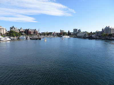
James Bay is the name for Victoria's inner harbor, the urban saltwater pond out in front of the Empress Hotel. I got to enjoy it from the holding pen inside U.S. Customs, waiting for the M.V. Coho to arrive and from the deck of the Coho once it did arrive.
 The bay was buzzing with activity (imagine what summertime would be like). Water taxis, tour boats, seaplanes, kayaks, and occasional pleasure boats. Crowds chanted for the buskers below the Empress and the music of street musicians echoed off the wall behind the waterfront promenade.
Labels:
british columbia,
canada
Location:
James Bay, Victoria, BC, Canada
Victoria

Sunday was spectacular, as was Victoria. This is a ridiculously scenic city with views in all directions across water.
 I was headed for the inner harbor to catch the Port Angeles ferry, but I took the long looping way to get there, working my way around Beach Drive and Dallas Road past Cadboro, Oak, McNeil, Gonzalez, and Ross Bay. Mount Baker to the east, the Olympics to the south.
Labels:
british columbia,
canada
Location:
Victoria, BC, Canada
Thursday, October 17, 2013
Sooke
 Sooke is far enough west of Victoria to feel like a town, not a suburb, but it's also pretty much the last place with much of anything on the road to Port Renfrew. Heading west on Friday, I took advantage of Serious Coffee's WiFi to touch bases with M and to make reservations on ferry home, then I checked in there again on Sunday as I headed back. I had a Verizon signal most of the way out the Strait, but wasn't sure it was an American one from across the water or a really expensive Canadian one! And it was sort of nice to be off the grid, anyway.
 Besides Serious Coffee, I also stopped at Whiffen Spit going both ways - Sunday morning's sunshine was much better for photos than Friday afternoon's overcast. I made a mental note - not the first time - to come back with M sometime to check out the Sooke Harbor House.
Labels:
british columbia,
canada
Location:
Sooke, BC, Canada
Strait of Juan de Fuca
 This whole trip pretty much followed the northern shore of the Strait of Juan de Fuca, from Victoria to Port Renfrew, from urban shoreline to wilderness beach.
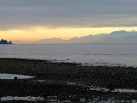
 The weather was pretty overcast until midday Saturday, but once it cleared up it was spectacular, and the views across to the Olympic Mountains were great.
Labels:
british columbia,
canada
Location:
Capital, BC, Canada
Sombrio Beach

 The sun had come out by late Saturday afternoon when I arrived at Sombrio Beach. After a day of seeing relatively few people, and after a drive down a road where I expected to find even fewer, I was pleasantly surprised to find out that this was clearly the place to be. It was mainly a surfing crowd - a crowd meaning 40 or more - some with pets and families in tow. The waves were pretty small, but it looked like a nice way to spend a nice October Saturday afternoon - as long as no one minded the long drive out from Victoria.
I've learned that Sombrio has quite the reputation - maybe not Tofino - but definitely a place folks have been coming to surf for decades. And a really nice beach for exploring, too.
Labels:
british columbia,
canada
Port Renfrew
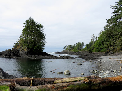
 Port Renfrew isn't exactly at the end of the road, but it sure seems like it. It is about as far west as you can go along the southern coast of Vancouver Island without a boat, or hiking the West Coast Trail. I explored the beach at the head of the bay - on Pacheedaht tribal land - which sort of looked like where old trees go after they die.
 And then I went out to Botanical Beach, where the tide was too high to really appreciate the botanical part of the beach, but which was still wonderful and a great counterpart to Cape Flattery, just 15 miles away on the other side of the Strait.
I ended up back to the Port Renfrew Hotel/Pub for a late lunch and my closest brush with civilization all day - except for the coffee place with WiFi on the way out of town.

Labels:
british columbia,
canada
Location:
Capital, BC, Canada
Wednesday, October 16, 2013
French Beach
M was in the Bay Area for the weekend. And it sounded like my plans to backpack in the high cascades would be buried by early season snow. And I wasn't sure if I'd be fined for hiking into Shi Shi or one of the other Olympic Peninsula beaches while the federal government was shut down. So I headed north, to Canada, and spent two nights camped at French Beach on Vancouver Island west of Victoria. It was weird to be on the Tsawwassen ferry by myself without the whole Salt Spring crowd!

Once again, my best laid plans to go backpacking go sideways and I end at the beach - I guess this shouldn't be a surprise. But what a neat bunch of beaches - from Botanical Beach at the west end back to Ross Bay in Victoria, and half a dozen in between. All now cataloged and described at Gravel Beach, of course.
Labels:
british columbia,
canada
Subscribe to:
Posts (Atom)


