Sunday, July 28, 2013

Big Sur


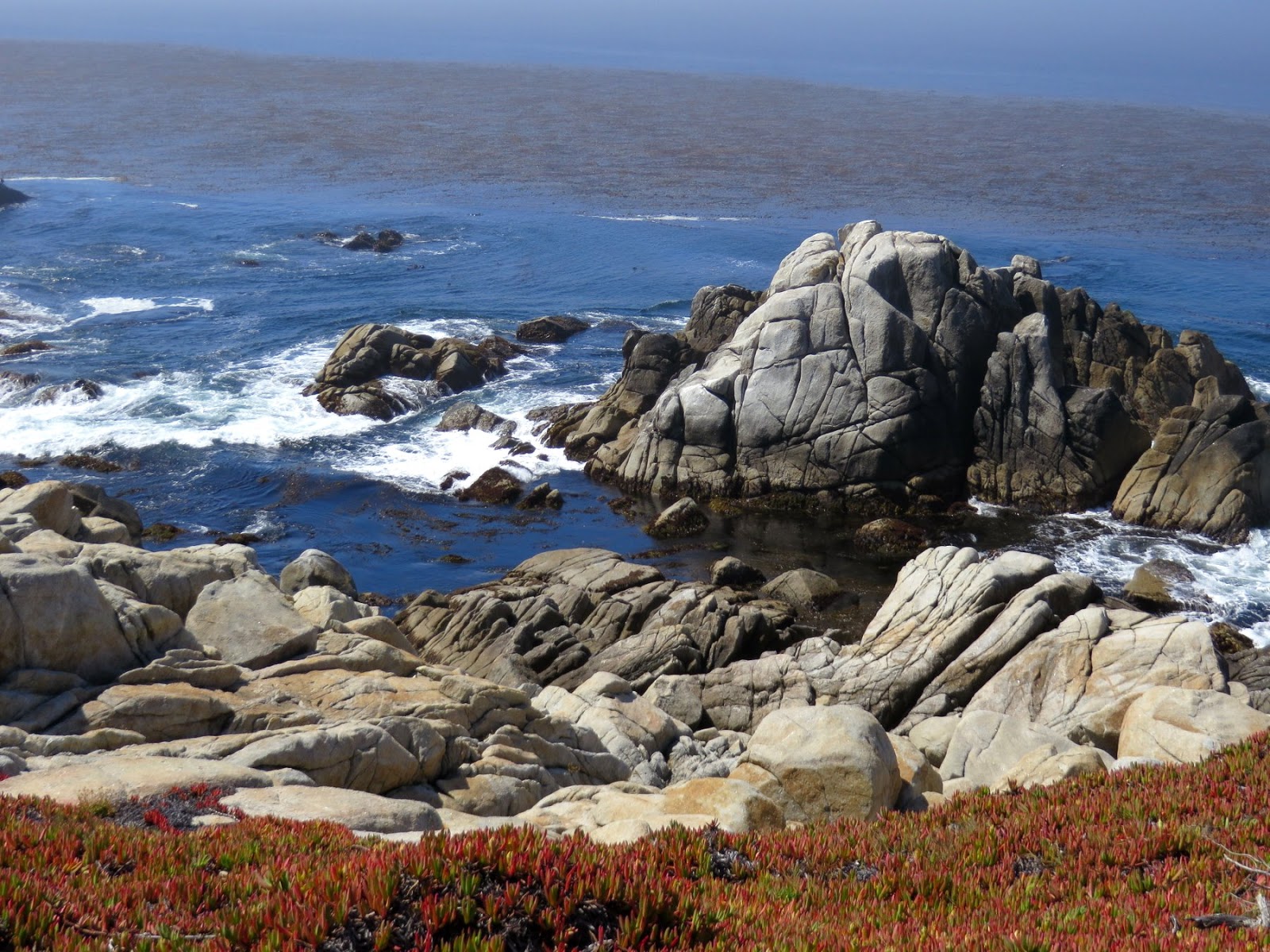
I guess it's sort of typical for this time of year, but I spent the afternoon in and out of fog banks on the drive down the coast.  I stopped in as many places as I could, but it would be nice to come back with enough time to explore a little more and to simply hang out a little longer in some places.

I was reminded that there aren't too many places you can get down to the beach, given both the terrain and the fact that much of it remains private, but I also know that there were a great many that I missed.

I drove as far as Gorda before turning around and heading back. I had a reservation near the San Jose airport and a very early flight the next morning.


Bixby Creek Bridge


Besides its spectacular coastline, its fog, its isolated private hideaways, and its inland forest, Big Sur is known for the Pacific Coast Highway (CA Route 1), which winds its way around steep headlands and soars over deep ravines on a bunch of beautiful 1930s concrete arch bridges.

The Bixby Bridge (1932) is the highest of these and from the crowd gathered at the north end, either the most popular or the easiest to pull over to photograph.  Maybe those are the same thing.

Carmel


Carmel was still fogged in when I arrived at lunch time.  Pretty, but fogged in.  The beach was crowded with people bundled against the cool marine air - it wasn't exactly sunbathing weather.  I skipped the high-end retail corridor and stuck to the shoreline all the way through town, keeping my fingers crossed that the fog would lift a little more before I headed south.


Seventeen Mile Drive


The 17-mile drive is a quasi-public route that winds along the shore of the Monterey Peninsula, past spectacular granite headlands and beaches, through neighborhoods of stunning houses, and around a series of golf courses that used to be sand dunes and Cypress groves.


It reminded me of Acadia. The granite, the coastline, the proximity to wealth.  In an ideal world, the Monterey Peninsula would be a National Park.  In another ideal world, it would be mine, and the only house would be my modest stone cottage overlooking Cypress Point.


Cannery Row


I had left plenty of flexibility Wednesday and decided that Monterey would be better in the morning than at the end of the day when I was racing to get back to San Jose. The first order of business after checking out was to find a good cup of coffee, so I headed down to Cannery Row before the meters kicked in and the Aquarium opened.  I found coffee. I found MacAbee beach (see Gravel Beach). I found the site of Ed Rickett's lab squeezed in, and preserved, between hotels along the waterfront.


Lover's Point


I arrived in Monterey late Tuesday night to thick fog. The fog was still there when I got up and added some mystery to my first walk out to the point. A group of Asian tourists was doing a group exercise on one of the overlooks. A young woman was doing yoga on the beach. Joggers emerged out of the fog, only to disappear right back into it.

By the time I finished breakfast at the little patio in front of the hotel, the fog had begun to lift, and my second walk out to the point looked completely different than my first.

I wasn't in a big rush to head towards Carmel and Big Sur, since I figured the afternoon would have less fog and better western light, so I took my time.


Santa Cruz


My visit to Santa Cruz was more a series of short stops as I worked my way west along Cliff Drive from Capitola, through Santa Cruz itself, and out the west side of town.  I walked down to the pier, left a couple of souvenir shops without postcards or t-shirts, and watched some volleyball, but I decided to save the Boardwalk for a return trip with M.

Blue skies and some more exciting surf would have perked this place up a little.  The gray skies made it a pretty bleak Monday morning.


Capitola


A workshop at Stanford brought me to California this past week and I took advantage of a day on each side to explore some of the central coast. I flew down to San Jose very early on Monday, picked up my rental car, and did a loop to Santa Cruz, Ana Nuevo, Half Moon Bay, and back to Palo Alto.  It was a little gray and a little muggy, but otherwise a great 6-hour drive with a few dozen quick photo stops.

I made it to Capitola on Monday morning and again late Tuesday evening and the pictures come from both - so don't look for consistency in lighting and weather.  On Monday, the Esplanade Beach was packed with big groups of kids camps - I guess it's easier to keep track of them if they all wear bright red swimsuits!

Lake Union


Another beautiful Sunday afternoon and we decided to give C a driving tour of the city, which ended up including a walk through the new South Lake Union park.  This is really turning into a neat public space and although I haven't actually visited MOHAI's new facility, it seems like a great fit and a definite improvement on the old location in the Arboretum.

For dinner, we all headed down to Ivar's where we watched the University Bridge open and close several times, listened to the roar of the I-5 express lanes reflecting off the bridge deck above us, and figured out that Daedalus is the Boeing yacht. I guess if you build airplanes, that's a pretty appropriate name for your corporate party boat -- and certainly a better one than Icarus, given the recent problems with overheated Dreamliners.