Friday, September 14, 2012

Cypress Hills


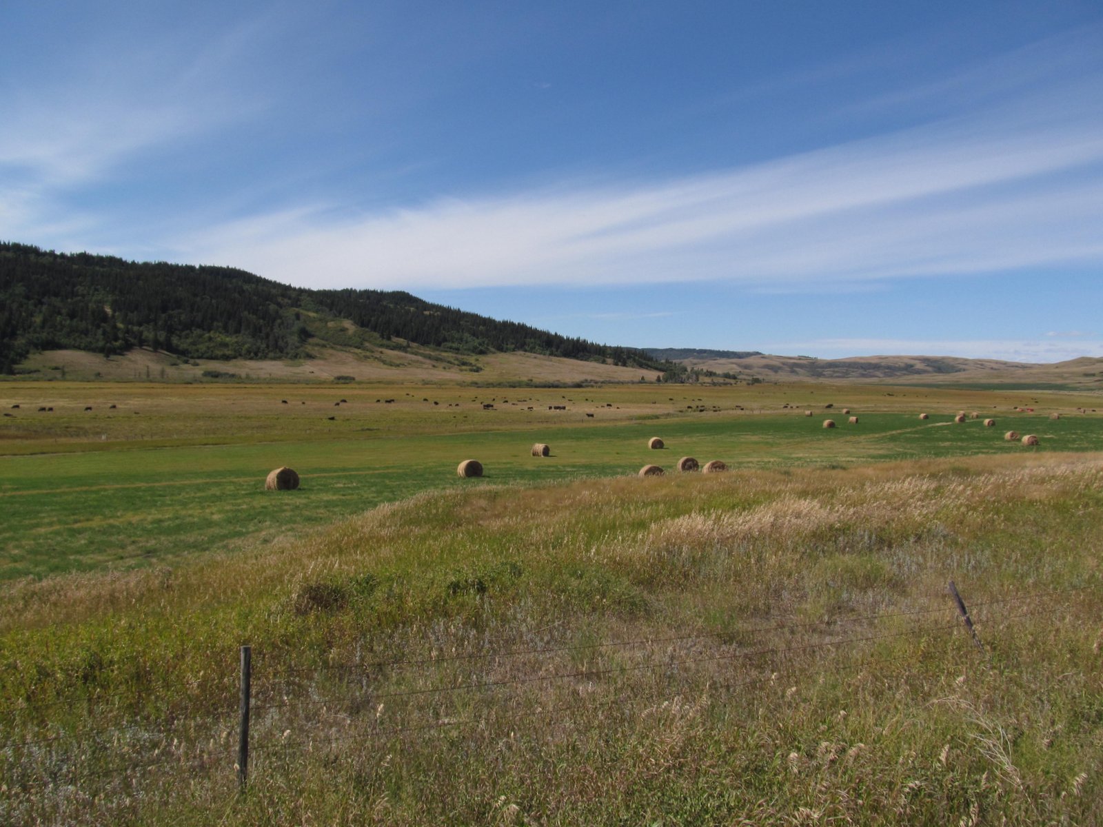
Today's itinerary offered a direct route from Lethbridge to Regina.  But my route (and therefore the family's route) took in a loop south from Medicine Hat so we could explore the Cypress Hills.  It was the end of a long weekend and there was a steady stream of RVs heading back to Calgary and the other prairie towns as we drove in.

The prairies are powerful places for me - thanks, I suppose, to long family driving trips as a kid and a fair amount of time spent living in oil towns in these wide open grasslands that fan east from the Rockies. As much as I love the Rockies, it was reaching the prairie east of Crows Nest Pass yesterday afternoon that moved me the most.  Endless rolling late season wheat fields back lit by the low sun helped, too.

The Cypress Hills are a small remnant of an earlier higher prairie - one long since removed elsewhere by meandering rivers flowing east.  Its height left it perched above the glaciers, so the partially forested surface is an extremely old one in this part of the world where most landscapes are young (if 12,000 years is young).  One of these photos shows how flat the upper surface remains - the very fact that it is higher than its surroundings means that there are few streams to erode it, except at its margins (and there, only slowly).

I find these little bits of high country surrounded by prairie enchanting.  Riding Mountain National Park in Manitoba. The Turtle Mountains on the North Dakota-Canada border.  The Rockies are full of small mountain ranges surrounded by high sage steppe, but these are lower, more remote from the mountains, and much more subtle.

These were important places for First Nations peoples.  They harbored game, provided water and refuge, offered timber for shelter and firewood.  They were strategic landmarks.  They were often the sites of skirmishes as settlers moved into the region.  They have also shaped western literature and sensibilities.  Wallace Stegner lived south of here and wrote Wolf Willow about that time.

Lethbridge


Lethbridge lies amidst the prairie about where the front range disappears from the western horizon.  It's flat, except for the valley of the Oldman River on the west edge of town. The Oldman drains the eastern front of the Rockies in both Canada and the U.S., including Saint Mary Lake in Glacier National Park and Waterton Lake.  In eastern Alberta, the Oldman joins the Bow (from Banff and Calgary) to become the South Saskatchewan River which eventually flows to Hudsons Bay via the Nelson River.

The railroad spans the 300' deep canyon on a mile-long steel trestle built in 1909 - one of the longest and highest in the world.  The valley is mainly park space with a wonderful network of trails.


Sunday, September 09, 2012

Castlegar


For the second time this summer, I'm heading east to Minnesota in the new (but increasingly less so) Subaru.  This time, M is along and D will be with us for the first half of the trip. We will leave him and his bike and his stuff in Minnesota in a week.  The first trip, in late May and early June, is documented in 24 posts at  RoadTrip2012.

M and D claim to enjoy these expeditions, and even support longer variations, but are pretty much useless when I ask for input on routes or places of interest.  Which is okay, since it lets me pursue quirky destinations that would be difficult to make a convincing public argument for.  Like wanting to see the Columbia River north of the border, the big coal mines on the west side of the Crows Nest Pass, the railroad trestle in Lethbridge, the Cypress Hills, and the north shore of Lake Superior.

Saturday we drove over the North Cascades Highway on a beautiful day and worked our way across Route 20 to Omak and Republic and (almost) to Kettle Falls.  We drove up the Columbia, past the junction with the Evans Cutoff from Colville, where I spent a night sleeping in a pasture amidst cow pies on my month-long pre-college walkabout in August 1976.

Castlegar is where the Kootenai (sometimes Kootenay) River joins the Columbia. It's easy to forget that the Columbia and its Canadian tributaries drain much of the west side of the Canadian Rockies, not just the interior northwest of the U.S.  Early Sunday morning, I tried different ways of getting down to the water's edge at the confluence - succeeding below Selkirk College on the east side and at Zuckerberg Island on the west (the island is on the Castlegar side and is not named after Mark Z of Facebook fame).

The river flows freely here, but dams are everywhere up and down stream and flood control has left its mark in the form of cobble banks now heavily overgrown with trees.

AERIAL VIEW


Thursday, August 30, 2012

Green Acres


Some years I come up with really interesting and creative shots of the lake - not this year!  But it was a great week. The weather was warmer than usual.  The bugs were few.  The other guests were the same old crowd - which is exactly as we like it

Salt Spring Island


This year, we stayed closer to Green Acres.  A sore back discouraged me from taking kayak out to salt water, nice weather gave us little reason to wander from the lake, and a concerted effort to save money reduced the number of trips to town for expensive meals.

In addition, I found myself taking far fewer pictures. Maybe it was an intentional retreat from the excess of previous years.  Maybe it was that some of the subjects seemed fairly similar and not worthy of more shots.  But regardless, I came back with relatively few shots from which to choose for this post.

The island was as wonderfully pleasant as it always is - and with this week's weather, maybe even more so.  Other than the visit to Windsor Plywood for a fan and the standup paddle boards at the lake, I don't think we did a single thing new this year!

Tsawwassen


Our August routine has continued for fifteen years!  We head up to the south side of Vancouver on Friday -- usually Richmond or Tsawwassen.  That way we get the border out of the way, have a nice dinner, and get to play on the water slide at the Sandman.  And then Saturday morning, we all get together in the line for the ferry, mill around drinking coffee and eating gelato, and then sail to Salt Spring, arriving in Ganges a little before the vendors at the Saturday Market start breaking down their booths.  We leave a week later at about the same time.

La Conner


A few of weeks ago M and I came up here for a getaway.  We had dinner at Seeds and couldn't help but notice the enormous cream puffs in the pastry case.  Of course, we were not tempted at all and just walked away.  I suppose the fact that we were already stuffed helped.

But on Friday on the drive up to Canada, just a couple of weeks later, we found ourselves thinking that La Conner wasn't really that far out of the way and that it had been at least a couple of hours since lunch.  And of course, we had an undernourished child to provide for...

Tuesday, July 24, 2012

Seattle Waterfront


This evening was a pretty perfect one here in Seattle.  D left to play Ultimate after dinner (his lunch) and I convinced M to head downtown and ride the new Ferris Wheel with me!  Some guy handed us an extra parking sticker, which saved us a couple bucks (a small dent in the $13/person tickets for the ride).

The "Great Wheel" is a bit of a novelty - and sort of sticks out along the waterfront - but it's a great view and was a fun midweek alternative to Jeopardy.  And I sort of dread what this thing will look like by the middle of its second winter, when the ridership doesn't bring in enough to pay someone to wash the seagull droppings off the glass!


Thursday, June 28, 2012

Craters of the Moon


Another drive-by National Park.  I guess if I was on my own, I would stop at all of these places, but then I'd get in later at night (or maybe just have to get started before 10:30 in the morning).  We drove the loop, but I stopped only long enough to wander through a few exhibits and to take a few pictures.  Admittedly, I think we'd crossed that divide where getting home just seemed like the highest priority and we still had a long ways to go.

Rendezvous Mountain


The map of this trip is two zig-zag lines that occasionally come together briefly - in Northfield, in Gillette, in Yakima, in Seattle, and in Jackson, Wyoming - but never completely cross.  That means this time I already knew where to find the coffee shop in Jackson while D slept in.  It was another beautiful day.

Our first stop was Teton Village, where we rode the remodeled tram up to the top of Rendezvous Mountain.  Jackson Hole was probably the ski area I most dreamed of visiting (or working at?) back in the days when such things were still in the realm of possibility.  But I'd never been to the mountain - summer or winter - until this trip.


Yellowstone Lake


I'd dreamed for months of a chance to finally explore the beautiful spits on the lake (Gravel Beach 2007) - I had even thought about bringing my kayak or renting a boat.

The reality was that we came through Cody pretty late in the afternoon and there were few options for staying in the park.  So we drove right on through, while I stewed about the beautiful weather, the lack of crowds, and those elegant gravel barrier beaches.  I did get one spit stop right along the road.  D stayed in the car, but I spent 20 minutes with my camera and an empty beach.  I even skipped stones.

We had a nice, but very slow and very expensive dinner in Grant Village, and then drove past the Tetons silhouetted against a late evening sky.  Some day I'll come back and walk more of the beaches.


Wednesday, June 27, 2012

Devil's Tower


We turned left off of I-94 as soon as we hit Montana and drove south through Baker.  I figured out where I rolled my S-10 in that freezing rain in December 1982.  But this time I got to finish that trip - in much better conditions.  We clipped the bottom right corner of Montana and headed into Wyoming, where we had a late lunch at Devil's Tower.  I wandered through the visitor's center and thought about walking around the base, but decided not to push my luck with D's patience.  We were back in the Fairfield Inn in Gillette that night, six days after I had stayed there going the other way.

Medora


D wrapped up his final and his computer project, I got back from Red Wing, we had lunch together, and then we spent a frenzied afternoon cleaning up the year's debris from the floor of his half of the dorm room.  I learned where the laundromat in Northfield was and commuted back and forth before stuffing bedding into card board boxes for the summer.  He returned his key and got checked out.  We hit the road and made it to Fargo by late evening.

Our trip back from Minnesota wasn't exactly direct, but it was definitely faster than my solo eastward journey.  Straight across I-94 in North Dakota, past the giant bison, past the giant heifer, and past the giant Geese in Flight on the Enchanted Highway.  Then I gave D a tour of Dickinson - the Queen City Motel, where I lived with the doodlebugging crew for three weeks in 1980.  Past the apartment where I spent much of 1982.  Past Dickinson State where I took my GREs.

We ended up camping along the Little Missouri north of Medora in Theodore Roosevelt NP.  Turns out this campground was underwater a year ago this time. We had breakfast the next morning at the Roughrider Hotel in town.

Red Wing


Having driven all the way to Northfield, I felt compelled to at least get as far as the Mississippi River.  So while D finished up his finals Monday morning, I drive the last 30 miles or so to Red Wing.  I crossed the river, got out of the car briefly, turned around, and began the long drive back.  I liked J's analogy - when you swim across the pool, you really need to push off the other side in order to come back. You don't just stop 5' away, tread water, and turn around.

The Mississippi was running a little high, though not seriously so.  It is an impressively large river, even this far upstream.