Showing posts with label cascades. Show all posts

Wednesday, October 17, 2018

Knife Edge

I think this is a pretty common name for hiking and climbing routes in similar settings, but it certainly fits this place well. North of Old Snowy, the PCT follows the crest of a jagged ridge for a mile or two. I followed it to Elk Pass, before turning around and heading back.

The trail is pretty good (though sections were covered in packed snow) and while it drops off steeply in both directions, it's not terribly precarious. I've found myself increasingly sensitive about exposed heights in recent years (Vors Fleslers Kirke), but even the snowy switchbacks down from Old Snowy didn't bother me much.

It might be interesting in some places were one to encounter pack horses, or converging packs of goats, but there was only one other party and they didn't go the whole distance.

The regular PCT goes up and over the shoulder of Old Snowy - but there is an alternate trail designated for pack animals that cuts across the broad talus on the mountains northern slope. It's an easy enough route, but there were rocks constantly rattling down the slope as the sun warmed the icy slopes.


Old Snowy

Mount Gilbert is the highest point in the Goat Rocks, at 8200' (it's the ragged peak in the earlier Goat Rocks post). At 7930', Old Snowy isn't quite so high, but is still a significant landmark. These photos capture the mountain from a number of different directions. Old Snowy had several large patches of old snow, and there was new snow in the shadows and along many sections of the trail.

The PCT crosses a high shoulder about 300' short of the summit - which is as close as I got early Saturday morning. A couple of women passed me and summited 25 minutes later, but the icy rocks, their apparent difficulty in route-finding, and maybe my caution as a solo hiker, all convinced me that I didn't need to try it.

By mid-afternoon, when I was heading back to camp, there were more people heading up (some poorly equipped, some with dogs, and some who actually looked like they knew what they were doing). But again, I thought better of it, or chickened out, depending on your perspective.


Snowgrass Flats

Snowgrass Flats was home for two nights. I camped in one of the many great sites scattered around the junction of the Snowgrass Trail with the PCT. The only drawback was that this late in the season, there's not much flowing water. Oh, and another drawback, what water I did have froze in the bottles at night. I think it must have been around 20 at dawn. And windy at night. Particularly Sunday morning.


I was reminded what an impressive peak Mount Adams is. As opposed to Mt. St. Helens, also visible (bottom panorama), but much diminished since its small setback in 1980.


The roughly five mile trail in was in good condition. And since the trailhead is around 4500', the elevation gain isn't bad. Snowgrass is a great base camp for exploring the more exposed areas of Old Snowy and the Knife Edge, which I'll get to later.


Goat Rocks

The theme of the last few weeks has been beautiful fall weather in the Cascades. And the next few posts are more of the same. The challenge has been deciding which subset of photos to actually post. And in this case I've split the three day trip into at least four posts and included more photos than I probably should have.

I had never been to Goat Rocks. I'm not even sure when I was last in Packwood (the closest I can recall was Ohanapecosh with D back in 2011). Unlike my Olympia friends, I never go to White Pass.  But by 11:00 on Friday morning, I was headed up the trail to Snowgrass Flats (I parked at Berry Patch, since that's where I would return early Sunday afternoon).


The Goat Rocks are the remnants of an old volcano, roughly half way between Mt. Rainier and Mt. Adams. The crumbly volcanic rocks rise well above 7000' in places, way above timberline and offering views of just about everything. The Pacific Crest Trail runs down their spine - precipitously so in places.

The days were pleasant, the nights were bitter, and the colors were great. There was snow from last year, and snow from last week. There were goats, but they were far away.


Monday, October 08, 2018

Artist's Point

We hadn't been up to Mount Baker in a long time. It's a long drive from Seattle and other mountains seem more convenient, but I'd forgotten what an impressive spot this is - particularly on a beautiful fall day.


It rained on Friday and it was scheduled to rain on Sunday (it did).  But the forecast for Saturday looked pretty good. M will be grading papers next weekend so it seemed like a great day to go somewhere. Of course, we weren't the only ones with the same idea and the parking lot was overflowing with tourists, locals (I consider Bellingham local to Mount Baker), and a few of us Seattle types.

What a day! We made it back to Burlington for dinner at the Train Wreck and were home by eight.


Sunday, September 30, 2018

Mount Defiance

Saturday was a nice fall day to go for a long walk in the mountains. The Ira Spring trailhead is only a little more than an hour from the house and I got there by 8AM, before the main lot filled up (as usual, the cars were parked a quarter mile down the road by the time I left at 2PM).

Seven years ago, D and I hiked up to Bandera and Mason Lake (Bandera: June 2011). That time, it was pretty early in the season and the lake was still snowed in. This time, the snow was long gone, replaced by fall colors.

The trail to Mason Lake is very good and relatively fast, despite the climb. The trail on up to Mount Defiance is steeper, particularly the final stretch up its southwest ridge. The clouds were beginning to come in, but the temperatures were perfect.


Tuesday, August 07, 2018

Skagit River

It turns out the loop from Arlington, up to the Skagit River and east to Concrete, up the Sauk River to Darrington, and then back down the Stillaguamish to Arlington, is just over 100 miles. And while there are some hills, none are terribly long or steep. That's why I had been eyeing this for awhile, thinking it might be a good place to try riding a century.

And I made it, albeit a little slower than I had hoped. The first half went remarkably fast, which may be why the second half went a lot slower. Of course the headwind and all the gravel on the shoulder of SR530 on the last 25 mile leg sure didn't help.

The bike worked well. The legs worked well, though they're still sore four days later. And the seat and the neck and the wrists all made it relatively unscathed. I had two bee stings. And the two dogs (yes, I believe they were pit bulls, but I didn't slow down to ask them) who chased me down on Route 9 north of Big Lake made contact, and scared the hell out of me, but didn't actually bite (or if they did, they missed).

This was the first time I'd ridden more than 100 miles on my bike since high school - one of those long loops in central Maine or the first day of that four day trip to the White Mountains? But I don't need to do it again for a little while.

Sunday, May 27, 2018

Reecer Creek Road


Reecer Creek Road heads north (with a few westerly jogs) across the broad slope above Ellensburg. When it hits the hills, it becomes Forest Road 35(00) and continues as a single lane paved road all the way up to Table Mountain.

Ellensburg is near 1500', the National Forest begins about 3000', and the pavement ends somewhere above 5600', which makes for quite a climb. Two bicyclists were working their way up the hill as I drove up  -- looked like a lot of work. I was glad to be in the car.

The upper section passes through the burn from the 2012 Table Mountain Fire. The landscape was still pretty stark, although there had been enough time for small trees to get started. It was amazing to me to see that there was a small enclave of homes near the top. Crazy place for residential construction - and it sure must complicate the fire management equation. Next thing you know people will be building homes on eroding cliffs in California and barrier islands on the Gulf Coast ...


Tuesday, May 15, 2018

Beacon Rock


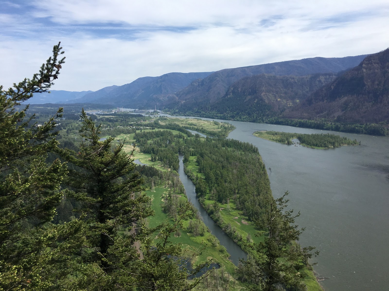
Beacon Rock is an 800' rock monolith standing on the north bank of the Columbia just downstream of Bonneville Dam. It's also a State Park and there is an amazing trail that zigzags its way up to the top.

We had detoured east from the I-5 Corridor to visit the Columbia Gorge on our way down to Portland - it was the first time in a very long time (maybe ever?) that we had driven the Washington side of the river through this section. After Beacon Rock, we passed the dam and crossed the Bridge of the Gods to Oregon. Where most slopes were charred from last year's fires.

The gorge is carved through Columbia River Basalts, which flowed this way to reach the sea before much of the modern Cascades formed. The lava flows are many millions of years old, whereas Beacon Rock is a basalt plug that formed the core of a small volcano a little more than 50,000 years ago. Very different stories.


This section of the Columbia Gorge has a rich geologic history. Besides its volcanic features, the canyon is significant in that the Columbia is the only river between the Fraser and the Klamath that cuts through the Cascade Range, which otherwise forms a stark drainage divide between the damp coast and the dry interior. At the end of the last ice age (less than 20,000 years ago), as many as 100 catastrophic floods rushed through the Gorge as Lake Missoula repeatedly emptied out from behind its ice dam in northern Idaho. And then, just a few hundred years ago, a huge landslide occurred on this side of the river just above Bonneville, pushing the river to the south side of valley. Interestingly, the dam right is built right at the toe of this large slide.