Thursday, November 28, 2013
Thanksgiving
Besides a 21 lb turkey, we sacrificed a lot of sweet potatoes, an amazing amount of butter, a chocolate pie, and a few bottles of wine, but it was all for the greater good. Most of the gang is in the living room playing Tripoley - hard to tell from the exclamations and accusations who's actually ahead.
This was sort of a mixed year. Mom and Dad stayed home - I suppose this kind of thing is getting a little tough on them although we would have loved to have had them with us. I think we'll be running rations of turkey and stuffing over to their place tomorrow. Bubbi, on the other hand, showed up from San Francisco an hour or so earlier, which was a wonderful surprise. It turns out D was an integral part of the scheme. What a bunch of jokers!
Labels:
seattle,
washington
Location:
Seattle, WA, USA
Black's Beach
I got back to the Torrey Pines gliderport - where the sun set last night - after lunch and figured I had time to hike down to the beach and explore before racing back to the airport. The gliderport is mainly some big parking lots and dirt and grass fields where the daring can launch hang gliders or model sail planes. It is backed up by the high tech biomedical labs and businesses that have grown up around UCSD.
But 300' below, down a steep trail is Black's Beach, known as much for surfing and naturalism as for geology, but of course, I was there to check out the beach sediment and the landslides. I avoided the main part of the clothing optional beach by heading south (and I did take my shoes and socks off, which seemed to me like a clothing option).
La Jolla Farms is the high end neighborhood on top of the bluff - the more precarious ones can be seen from the beach.
What a wonderful afternoon - all the more because I knew in a couple hours I would be on a plane back to Seattle where it was cold and wet! The hike back up the bluff was tough and I was very glad to find a public shower at the beach at La Jolla Shores - I suspect the people next to me on the plane were glad, too.
Labels:
california,
san diego
Encinitas
I spent the night in Carlsbad, but was up with the sun and grabbed coffee and breakfast (probably a pastry) at a coffee shop near the beach. I spent most of the morning on the bluffs, or on the beach, working my way south through Carlsbad, Encinitas, and Del Mar, before winding back at Torrey Pines, where my day ended last night.
It was a gorgeous Saturday morning - maybe not summertime warm, but nice enough so that everyone was out enjoying themselves. There were runners and bikers along the coast road that I passed, or that passed me, repeatedly over several hours -- I had a car, but they weren't stopping every five minutes.. Hundreds of folks were out wandering the beaches and the surfers were piled up at the better breaks, although the swell wasn't terribly impressive. It must be nice to just be out on the water.
Based on some homework, and prompted by some suggestions from a friend, I checked out several classic beach spots in Encinitas, including Stone Steps and Beacons (more on Gravel Beach), and the Powerhouse in Del Mar. Conveniently, although completely by accident, I found the Leucadia Donut Shop. It was one of those little details that makes any road trip better.
Labels:
california,
san diego
Location:
Encinitas, CA, USA
Torrey Pines
My plan was to work my way north until I ran out of daylight, then head for the Econolodge in Carlsbad. Whatever I couldn't do Friday, maybe I could squeeze in on Saturday before having to race back to the airport. The challenge was that the sun was setting around 5, so I didn't have the luxury of a long evening of western light.
I made it to Torrey Pines - the high bluffs north of La Jolla - in time to watch the sun fall into the Pacific. I came back the next day and hiked down to Black's Beach, but I'll save those photos for a subsequent post.
As usual, my Gravel Beach blog parallels this one and includes many of the same places, albeit with slightly different photos and narrative.
Labels:
california,
san diego
La Jolla
You can't go very far in oceanography and marine geology without running into La Jolla - and Scripps, in particular. But I think this is the first time I've ever actually been here, except possibly driving through with the family when I was in junior high, although I suspect we stuck to I-5.
It's a pretty posh looking place - judging by the Friday afternoon luxury car traffic backed up in the village and the modest little cabins overlooking the Pacific. I worked my way north, stopping at road ends and bluff top parks and beaches, hoping to get to Torrey Pines before the sunset.
Labels:
california,
san diego
Location:
San Diego County, CA, USA
Monday, November 18, 2013
Ocean Beach
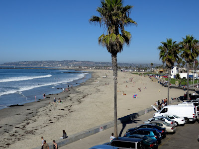
Ocean Beach lies at the mouth of the San Diego River and was centrally located enough to the conference in Mission Valley and to my excursion the following days that I think I passed through three or four different times, both at night and during the day.
A friend who knows beer better than I pointed us to the Pizza Port, where they must have had several dozen taps running. We tried several (flights of small ones) before heading over for fish tacos at the South Beach Bar and Grill.
I guess every beach town needs to have a unique pier and Ocean Beach has one that slopes down from the bluff before spltting into a "T" at the end. The town is a little unusual in that the street grid was 45 degrees to the beach - which creates sort of nice geometry of park space. And it even has its own Dog Beach, a sand bar that runs across the mouth of the river, or whatever's left of the river.
Labels:
california,
san diego
Location:
Ocean Beach, San Diego, CA, USA
Saturday, November 16, 2013
Point Loma
After my early morning trip to the border, I worked my way north through Imperial Beach and along the Silver Strand, back past the Coronado where I'd been on Sunday evening, and then back over the bay to Mission Valley and the hotel to check out. Then I headed out to Point Loma, the imposing headland that marks the north end of San Diego Bay. I actually tried to come out here last night, but didn't realize until I got to the gate that Cabrillo National Monument closes at 5 PM. Night or day, one is reminded driving out here how much San Diego is a military (Navy and Marines, mainly) town.
What a spectacular view of the city and of Coronado! I must have arrived around noon. The weather was perfect, except for the fog bank lying offshore. Which over about 30 minutes moved in very fast, spilling into the bay and over the ridge, which was all very impressive, but worried me given my ambitious afternoon schedule. I really wanted sunshine in La Jolla, not murk. As it turned out the fog wasn't a problem farther north.
Labels:
california,
san diego
Thursday, November 14, 2013
Tijuana
Border Field State Park was open, but the road into the park was closed, so I had to walk in from the entrance gate. The beach stretches north from the border toward the mouth of the Tijuana River and on towards Imperial Beach. I had it all to myself, except for the Border Patrol guy sitting in his jeep, although by the time I left, a few more folks could be seen in the distance. There were more people on the south side of the fence - the beach on the Mexican side is much more developed than it is on the American side.
This blog is occasionally guilty of geographic pandering or at least of flaunting geoesoterica -- state high points, major watersheds and divides, and so forth. In keeping with that rich tradition, this post completes an important set - the four corners of the continental United States.
Top Left: Cape Flattery, 2011
Top Right: West Quoddy Head, 2010
Bottom Right: Key West, 2006
Bottom Left: Tijuana, 2013
Nitpicking is possible, since while it is relatively straightforward to identify the eastern or northernmost points, it is less clear how one defines the most northwestern or southeastern, since you have two variables to work with. Is West Quoddy Head the eastest north and Presque Isle the northest east? But you get the point. And the southwesternmost point is unambiguously this one.
I could take this farther, so to speak, and mention Polihale (sort of westernmost) and Homer (sort of the end of the road).
Labels:
california,
mexico
Monday, November 11, 2013
Coronado
One of the challenges last week was that the sun was going down around 5, which really cut into the time available for exploring beaches (at least seeing them in daylight). I made it to the ocean side of Coronado Island about 4, which gave me time to wander the beach and arrive at the Babcock & Story Bar at the Hotel del Coronado at Happy Hour - which meant my beer and burger only set me back about $27, not counting tip. But it was a great place to watch the sun set over Point Loma.
The Hotel del Coronado is one of the classic grand wooden hotels of an earlier era - most have long since burnt down and/or been replaced by shiny towers.
The bottom photo in this set was taken several days later from Point Loma.
Labels:
california,
san diego
Location:
Coronado, CA, USA
San Diego
I had about 48 hours of discretionary time in San Diego last week packed in around the conference - which was held out in Mission Valley, nowhere near the water. I flew in on Sunday and spent late afternoon and evening exploring the downtown waterfront and Coronado Island, employing a combination of the trolley (SD's light rail) and the ferry to the island and an awful lot of walking.
I'd forgotten how much San Diego is about boats, although it makes sense given the amazing natural bay and the non-so-natural Mission Bay to the north.
48 hours was enough time to visit an awful lot of San Diego county shoreline and it will take a week or more to catch up with the two blogs.
Labels:
california,
san diego
Location:
San Diego, CA, USA
Subscribe to:
Posts (Atom)