Saturday, August 05, 2017

Stanley Park


When D was young (heck, we were all young), we came up here every summer for a weekend at the Sylvia Hotel, a bike ride around Stanley Park, and the fireworks. I guess that routine ended when D began high school, so while we've been back to Vancouver many times, we've done it differently.

But this year M and I decided to come back - we pretty much picked up the routine where we left off - albeit without D. The bike ride was great - thought a bit crowded. The weather was wonderful.

Writing this a week later, I'd note that right after we left, the heat went up and the smoke from the BC forest fires blew in, and the last week was probably not very pretty up there (or down here, either).


Thursday, August 03, 2017

Kitsilano


We checked into the Sylvia, dropped off our bikes in the storage room, and made some last minute decisions about dinner. Which led us to Kitsilano, on the other side of English Bay.

We walked along Sunset Beach, hopped on the water taxi below the Burrard Bridge, and then walked up to Oddfish on 1st Avenue. Oddfish is among the newer of Vancouver's 2000-3000 great restaurants - it only opened earlier this summer. It had a nice neighborhood vibe - we sat outside and felt we were the only customers who weren't chatting with their friends as they walked past.

We caught the last little ferry back to the other side and walked back along Sunset Beach (appropriately name) to the hotel - well, I guess we stopped so I could get ice cream first.


Squamish


Squamish sits at the head of Howe Sound, on the road between Vancouver and Whistler. It boomed in the buildup to the 2008 Olympics when the highway got improved and all sorts of new housing popped up, and now, like so many other places, it's trying to attract tourists and bill itself as a hub of outdoor recreation.

The Sea to Sky Gondola, which rises between Stawamus Chief (the granite monolith known well to climbers) and Shannon Falls, climbs from the highway up about 3000' (885 m) to the summit house, which is pretty much a ski lodge without the skiing. But there are plenty of well-maintained walking trails, viewing platforms, and even a dramatic suspension bridge.

Apparently, they had live music Friday evening, but by then we were already back in Vancouver.


Wednesday, July 19, 2017

Mount Rainier


At 9:00 we had no plans. By 10:00 we were on our way. Yet another pleasant day and we decided to go for a long drive. It's been a long time since we've been to Rainier together and a very long time since we'd driven the whole loop.

The Park was metering traffic at White River, which meant a long wait, but this probably made it less of a zoo up at Sunrise. We stopped at the snack bar for a simple lunch before heading on around the mountain.


I'm always impressed by how big this mountain feels, especially from close up. I guess most mountains are massive, but when they have broad shoulders and stand alone, they really stand out. Rainier was in and out of clouds all day, but we got plenty of great views.

Paradise was crowded, but we were still able to grab a parking spot in the top lot without much of a wait. We kept our exercise simple - the short paved walk to Myrtle Falls. Pretty much any other route would still have involved snow. The new visitors center (new, at least for us) was nice and the old lodge was even better. I still have visions of entering the lodge through snow tunnels when I first visited as a child (one must always be a little skeptical of such memories - brains can create data as easily as they can store it).


It always seems like a long drive back. We had dinner on the patio of the Copper Creek Inn, then headed to Des Moines so M could swing by her office and clear her floor of stacks of paper so the carpet could be cleaned. Why the carpet has to be clean (or even gets dirty in the first place) if it's covered in paper is beyond me.


Saturday, July 15, 2017

North Cascades Loop


My basic rule is that each post should be about a place - a fairly specific place. So I'm stretching this one to include a larger geography.

Given that I was already in the mountains, that it wasn't even noon yet, and that the only reason to come home wasn't at home this weekend, I decided to head east from Stevens Pass. I picked up lunch at EZ Burger in Wenatchee - I walked up to the window instead of driving through. Then crossed the river and climbed up toward Badger Mountain, glad for my air conditioning and glad that I wasn't riding the bike. The temperature dropped from the high 90s at the river to the high 80s up on the plateau. From there it was north, back down to the river and on to the Methow. I bought coffee in Twisp. I bought Gatorade and chips (and a t-shirt) at the Mazama Store.


Climbing toward Washington Pass, I bookmarked the road for a future bike ride. What a gorgeous late afternoon - and the first time I'd driven over the North Cascades in many years, let alone east to west.


Friday, July 14, 2017

Stevens Pass


The old Cascades Highway between Scenic and Stevens Pass doesn't get much use these days, since it's closed a mile or so up Tye Creek and there's only a foot bridge. But you can drive in from either direction. On a bike it's great, especially if you ignore the uphill aspect. I had the road almost all to myself - all 6 miles and 1400 vertical feet. It was very bikable, even for me, although I wasn't going awfully fast. Maybe next time I'll try to ride up from Skykomish.

I hung out on the patio at the Stevens Lodge for half an hour, texting M in SF and watching the mountain bikers. Summer at Stevens looks much like Stevens in the winter, except the snowboarders have been replaced by bikers (probably some of the same people).

The ride back down the hill was fast and easy and fun. Again, I had the two lane road all to myself. I did break it up by taking the gravel side trip to Wellington on the old railroad line.


Wellington marked the west entrance of the original Cascade Tunnel from 1900 until 1929, when the new tunnel was built lower on the hill. It's known for the avalanche in 1910 that killed 96 people trapped in trains stuck in the snow. I had read Gary Krist's White Cascade, about the Wellington disaster, back in 2010, exactly 100 years after the event. The spot is all forested now and despite good interpretive sings, it's hard to imagine the town, let alone the bare slopes that allowed for the landslides.

On the drive back out, I stopped at the west end of the new Cascade Tunnel. I was hoping for a train, but no such luck. It was only 11:30. I pondered whether to drive back into Seattle or whether to continue east and do the big North Cascades loop.


Thursday, July 13, 2017

Mount Dickerman


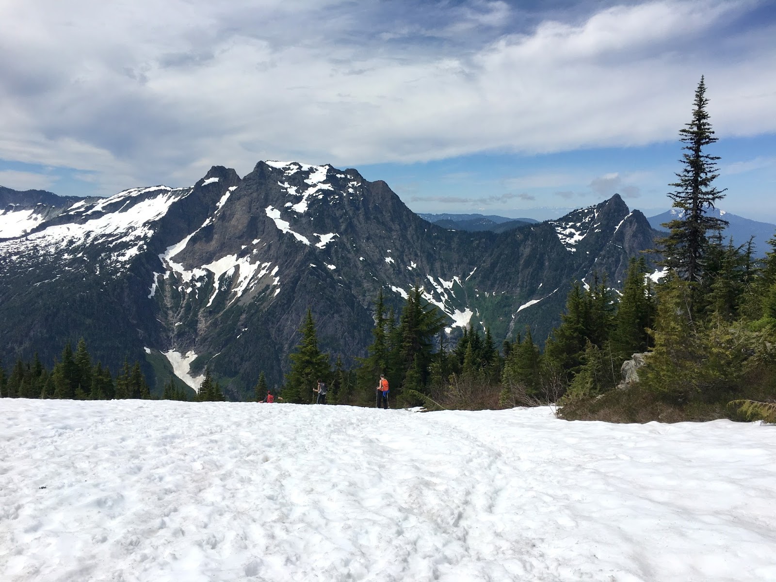
M spent the week in the Bay Area, so I was on my own on the 4th of July. I got an early start and was on the trail by 8:30. I had ridden my bike past the trailhead two weeks earlier on the way up to Barlow Pass and maybe that's what planted the seed for this trip.

I wasn't the only one on the trail, since this is a popular hike - easy to get to and great views from the top. It's a good trail, but relentlessly uphill - almost 4000' in just over four miles. There was still a lot of snow on the way up, but not enough to get me to stop and pull on the spikes.

It was crowded on top - a big meet up? group, I think. And a few dogs. One yipping, one nosing into folks' packs while owners chatted loudly with friends. The quiet solitude of the mountains!


Mount Dickerman really is a good place to take in the central northern Cascades, with peaks in every direction, including Glacier, Baker, and Rainier in the distance. But the closer ones - Del Campo, Big Four, and three Fingered Jack were just as good.

The last time I posted from here was a drizzly day up above Monte Cristo two years ago (Gothic Basin: October 2015).


Sunday, May 21, 2017

Potholes Coulee


Potholes Coulee is just a few miles north of Frenchman Coulee (previous post), but has a more diverse landscape, with a whole bunch of lakes (both above and below the rim). There are basically two large channels - Dusty Lake sits in the southern one, the multiple Ancient Lakes sit in northern one. It would have amazing to watch during the floods!

Looking West

Looking East
I hiked in from the Quincy Lakes Wildlife area above the rim - from where I parked it was less than ten minutes to the cliff edge overlooking Dusty Lake. I spent a couple of hours exploring the narrow spine (a fin if it were in Utah and perhaps a blade around here) that separates the two coulees - which afforded great views of the lakes on both sides. I'll save an exploration of the lakes themselves for some future trip, but this saved me having to hoof it all the way back up from the bottom.

Ancient Lakes

Route-finding was pretty easy - although it benefitted from earlier reconnaissance with Google Earth. And good views do not require any scrambling - let alone ropes. The flowers were out, the temperatures reasonable, and the rain squalls waited until I was back in the car. I did see one snake (I heard it first), but it was moving away quickly so I couldn't even get a photo.


Frenchman Coulee


I sort of knew this place was here, but never appreciated how close it was to I-90. A 15-minute side trip at the Silica Road Exit would be enough time to check out the view and still make it back to the freeway.

Fortunately, I had more than 15 minutes, so I drove all the way down to the river. I guess this was the route of the old road across the river to Vantage, before the Wanapum Dam was completed in the early 1960s and this part of the valley was flooded. The climbers were out - I also hadn't realized what a climbing mecca this was. Bicyclists were riding down to the river and back. Folks were camped along the way and cars were parked at the trailheads.

And a CWU Geomorph class was getting introduced to the role of the Missoula Floods in creating this landscape. There were many outburst floods from Lake Missoula, but they didn't all take the same route across central Washington (depending a little on which portions of the river were still blocked by ice). But many came down Grand Coulee (over Dry Falls) and then spread out across a broad fan below Ephrata. From there, they took several several paths into the Columbia Valley - including here at Frenchman Coulee and just north at Potholes Coulee (where I went next). The huge floods flowed over the cliffs, plucking and eroding out the basalt, head cutting the flat-bottomed coulees.

In the past, I've posted from Lake Missoula (Gravel Beach: 2011) and Camas Prairie (hshipman: 2014) at the upstream end of this whole flood story.

After a long day trip to Steamboat Rock in 2011, I told myself I should try to get in at least one good excursion to eastern Washington every spring. But somehow it just doesn't happen. Not that I won't keep trying.


Monday, May 15, 2017

Lithia Park


Ashland Creek flows right through downtown Ashland and the town has done a nice job of orienting walkways and restaurants along its edge. The best of these public spaces, and certainly the largest, is Lithia Park which extends a mile or two up from town. The lower part has playgrounds and artificial ponds and manicured gardens, but as you head upstream, the trails thin out and you are walking in the woods.


The geologist in me can't help but see a stream like this as a hazard. One really big rain storm sitting over the upper watershed for a few hours, after an already wet week, on top of a lot of wet snow, could probably do a lot of damage, both in the Park and in town. There have been some pretty big floods (1997, for example) and there are an awful lot of warning signs pointing uphill away from the creek bottom.