Sunday, August 21, 2011

Robin Lake


Perfect weather, great setting, and the packs weren't too awfully heavy. But the bugs! We could have been canoeing in the Allagash. Maybe it's this year's heavy, lingering snow that encourages them - and the fact that a whole summer's worth of fresh hikers are all showing up at the same time in mid-August. It wasn't just mosquitoes, since there were a variety of flies, too.

Did I mention the bugs? We hiked in on Friday -- the climb to Tuck is tough, the climb on up to Robin is beautiful, but also tough. We hoped, without much confidence, that going higher might get us out of range, but when we got to Robin, they were waiting for us. The DEET helped, but the little buggers still found gaps in coverage.

Robin Lake was beautiful. It is still partly frozen over and in the morning there was a fresh skim of ice on the rest -- I think it got to mid 40s in the night, but must of been freezing right at water level. We watched the colors shift as the sun set behind us, and then woke to sun coming over ridge to the east, filtered by thousands of little gossamer wings.

We had originally planned on day hiking above Robin on Saturday, but felt a little besieged and eventually decided to hike out. Maybe I'll come back someday and head up higher. I hope this didn't sour D too much on backpacking concept! Sunday is a rest day - if we could only stop scratching!


Sunday, August 14, 2011

Saturday Market


We arrive on Salt Spring every year in the midst of one Saturday Market and depart Salt Spring every year after spending a few hours in town during the subsequent one. A market like this works well in a place like this, where it seems like half of the population lives in bliss and near-poverty creating wonderful things and the other half lives in desperate luxury, lusting after what the other half provides - art, pottery, jewelry, goat cheese, tie dye dresses, and organic chocolate cookies.

Ganges Harbor


Friends mentioned that they had seen flyers announcing some sort of circus or aerial act on a sailboat and so we made a point of timing our Friday dinner reservations around it. We joined the crowd along the boardwalk and watched the Voillier Spectacle, an acrobatically talented couple who travels the world swinging from the lines oftheir sailboat. It was wonderful.


Mount Erskine


Every year I try to find a new place or two on the island to explore. This year I paddled into the lagoon at the head of Long Harbor, tried to paddle around to the beach at Walker Hook (but the water was too rough), and tried this hike up Mount Erskine.

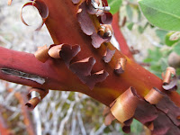
It's a steep trail (or network of trails) up the northwest end of the mountain, climbing through a mosaic of forests, including some beautiful madrones, until it breaks out onto rocky balds and cliffs at the top. The views toward Crofton and Vesuvius and up Vancouver Island were great (well, the latter would have been great, were the day less cloudy).

This trail is labeled the Jack Foster trail, but portions are also called the fairy trail, as there are numerous small doors mounted on stumps and boulders, each with their own collection of offerings (mainly plastic baubles and sea shells). I only noticed two, but am told there were many more.

St. Mary Lake


I have far too many pictures of this place taken over the years and I'm trying to occasionally come up with some new angles. But the old ones keep coming up, too.


Fulford


We went to Rock Salt for dinner one night and then came back another morning to eat at the Morningside Bakery and to visit the Salt Spring Cheese Company (which is just up the road a few miles). The Bakery was great - Michele and Carol really liked the Egg Panini. I liked the design of the patio - the airfoil roof, the wood, the benches hanging from block and tackle above our heads.

You can search the blog for "Fulford" and you'll find entries from pretty much every August.

Salt Spring Island


Our 14th or 15th year coming to Salt Spring Island. Every year is the same in many ways and that's part of the attraction, but every year we discover new places, too. The routine has changed a bit as the kids have gone from toddlers to college students and as their parents have gone from early middle age to later middle age. The routine will change a lot in the next year or two as the kids move on to create lives of their own - which may or may not include this little island.

Tuesday, August 09, 2011

Point Roberts


Our pre-Saltspring routine for years now has been to drive north, staying in Richmond or Tsawwassen Friday night so as to avoid a long drive and an unpredictable border crossing on Saturday morning. It lets us check out new eating places Friday evening and let's me go out and explore Saturday morning before picking up the family for breakfast and getting in line for the midday Long Harbor ferry.

This year, we checked into our hotel in Tsawwassen (one "s", two "w"s, and then two more "s"s), then drove south into Point Roberts, where we walked down to the beach at Lily Point. D lay on the beach and kept on top of his electronic goings on. M and I walked up, and then down, the beach, before retrieving him up for the walk back up the bluff. We had dinner at the South Beach House (great location and atmosphere, average food).

Monday morning I wandered down to Beach Grove, then over to English Bluff, and then up to Ladner, where I drove out to Westham Island, but didn't have enough time to explore before having to head back and pick up the family. We had breakfast at White Spot and were in the ferry queue by 11:30 or so.


Tuesday, August 02, 2011

Camp Muir


Camp Muir is at just over 10,000', high on the southeast side of Mount Rainier. It sits at the crest of the Muir Snowfield, about 4.5 miles and 4500 vertical feet above Paradise. It's the standard overnight spot for folks heading to the summit and a strenuous day hike for the rest of us.

The only thing that slowed D on the way up was his old man, since he was patient enough to stop and wait for me to catch up every few hundred steps. But a little more than four hours after leaving the parking lot, he arrived at Camp Muir. I staggered in ten minutes later. We munched on our salami and cheese and most of a package of cookies, and then headed down, sliding down chutes in our rain pants where it was steep enough and walking the rest. It was just over two hours back down.

Camp Muir is a dark speck between rocky hummocks just to the right and above the center point of the bottom picture - the tree is pointing just right of it. If you look carefully at the expanded image, you can see the tracks leading up the snowfield towards it.