Saturday, October 22, 2016

Ballycarbery


Ballycarbery is just down the hill from the stone fort at Cahergall, but was built a mere thousand years later (give or take a few centuries), in the 16th century. This castle is associated with the same McCarthy Mor clan (are they clans here, or just families?) who built the stone tower at Ballinskelligs - but is bigger. It must have once been much larger than it is now, but much has collapsed or been knocked down. And ivy (English Ivy, no doubt) is still trying to take down the parts that time and cannonballs have not.


With some scrambling, I found my way up to the second floor, which was really neat, before my traveling companion (still down below, of course) pointed out a sign discouraging this.


Cahergall


It was just a week and half earlier that we visited Grianan of Aileach, on a bleak hilltop above Derry. Since then, we had seen several more ring forts, in various states of disrepair and reconstruction. Ireland has thousands of these and while they share some common architectural themes, each of the ones we saw also had its own unique details.

The Cahergall Ring Fort outside of Cahersiveen was the largest, best restored, and most elegant we had visited. Plus the weather was nice. The stepped interior walls are a common feature, but here, where they climb a wall that is higher than the rest of the ring, they are particularly cool.


From here, we could see another ring fort higher up the hill as well as Ballycarbery Castle down towards the bay (next post). And Cahersiveen with its large church a little farther away. It makes for a wonderful mosaic of historic structures - some dating from very different centuries and millenia.

Knightstown


The only bridge onto Valentia Island is at Portmagee. To get off at the east end, you take a very short, very small, ferry from Knightstown to Renard Point near Cahersiveen.

Knightstown looks like it can also be Knight's Town. Or vice versa. I forgive myself this kind of confusion as I still don't know whether our summer retreat near Victoria is Salt Spring Island or Saltspring Island.

We shared a warm ham and cheese sandwich - a minor, but pleasant, variation from our typical picnic lunch routine of baguette, brie, and salami. Knightstown also provided me a very good latte - much appreciated on a trip where my coffee consumption was limited and where what I did have was often instant.


Valentia Island


From Portmagee and the bridge, Valentia Island looks like a long gentle ridge a few miles long. When you get to the crest of the ridge, you sort of realize that the north side of the ridge isn't so gentle and that it's a long way down to the ocean.

We began with a stop at the Skelligs Experience Visitor Center, which gave us a chance to experience Skellig Michael in the absence of actually being able to visit it. From there, we headed up to Geokaun Mountain, the highest point on the island (Geokaun sounds to me like a Scandinavian adventure sport or the name of a german SUV).

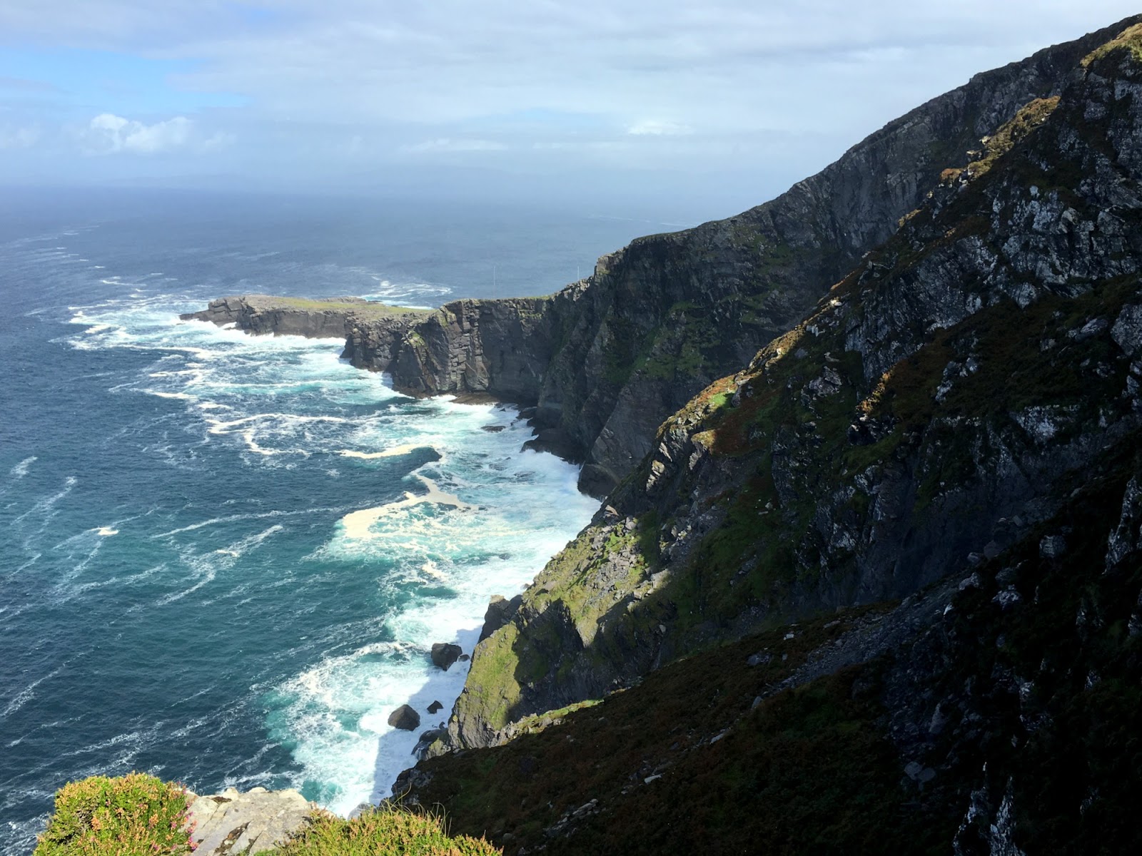
It's privately owned and you have to pay a small fee, but it was worth it. The short trail out to the Fogher Cliffs offered great views of the western end of the island and you could almost see Newfoundland in the distance (Valentia Island was the taking off point for the first transatlantic telegraph cable back around 1860). You could see a little bit of the Dingle Peninsula to the north and from the top of Geokaun you get great views east toward the rest of the Iveragh Peninsula.


Kerry Cliffs


On Saturday, we took advantage of better weather to loop up through Portmagee to Valentia Island and then back via Cahersiveen. Our first stop was at the Kerry Cliffs, another impressively sheer drop into the Atlantic. We watched a dark rain cloud out over Skellig Michael gradually get larger, only to realize that it was heading directly for us. We got back to the car almost in time. But that passed pretty quickly, and the rest of the day was fine.


St. Finian's Bay


St. Finian's Bay and The Glen are about half way between Ballinskelligs and Portmagee. We passed through several times under a variety of conditions. There's a neat little beach, great views out at the Skelligs, and a chocolate factory.

The road to Portmagee, not a bike path.


Skellig Michael


The title of this post is a bit of a misnomer, since we didn't actually get to Skellig Michael, but it lets me avoid another post with Ballinskelligs in the title.

We spent three days at the Seaside B&B in Ballinskelligs. One reason for the longer stay was that we had reserved time for a possible trip out to Skellig Michael, a sharp pyramid of rock several miles out into the Atlantic. The island is best known for its 7th century monastery - a cluster of beehive stone shelters perched near the top of the rock pinnacle - and its spectacular setting. It is a UNESCO World Heritage site and is a popular tourist destination - albeit a difficult one to actually get to (pictures of Skellig Michael).

Skellig Michael became even more famous - or at least many people become aware of it - following last year's Star Wars: The Force Awakens, since the final, short, scene where Rey finds Luke in exile, is set here.

About 10:30 the evening before, we got a call from the boat captain telling us that the trip was off because of the weather. Which we had sort of expected, since by then we'd heard the forecast for gale force winds and rain. We were already a little hesitant about a trip in a small boat on the open ocean, to a rocky island with hundreds of steep steps and no hand rails, in what might be strong winds and no visibility. Which meant the cancellation brought both disappointment and relief.

The result was a pleasant down day, something we rarely leave ourselves on trips. After breakfast, we didn't go anywhere. We set ourselves up in the conservatory and read and played scrabble, while the wind pounded the rain against the glass.

By three, things had calmed down a little and we headed out. First to the Skellig Chocolate Factory on St. Finian's Bay and then to Waterville for dinner.


Tuesday, October 18, 2016

Portmagee


We had arrived in Ballinskelligs Thursday afternoon, checked into our B&B, then wandered out to the beach, the castle, and the old abbey (previous posts). Then we decided it might be good to check out Portmagee, because there was a possibility we would be headed back early the next morning to catch our boat to Skellig Michael and we still hadn't heard back from the operator. It's about a 30 minute drive - which we would do a couple of more times before we left (these pictures are from at least two different days).

We didn't resolve our questions about the next day's excursion, but we had dinner at the Moorings and enjoyed the late day light.


Ballinskelligs Priory


At the west end of the beach, beyond the castle and across the marsh, are the remains of the old priory.

As with all of these old sites, there are layers upon layers. The original site dates to the 12th century. The monks who had spent 500 years living out on Skellig Michael (another story for a future post) finally gave up and decided to come back to the mainland (if Ireland can be considered the mainland). It turns out that it wasn't the horrible weather, the remote location, the endless breakfasts of puffin eggs, or the lack of overnight delivery that sent them scurrying back - it was Viking raiders.


The current church probably dates to the 15th century. And the church yard - really just a crowded cemetery - is filled with gravestones of all vintages, including some very recent ones. I can only assume that every time they dig a new grave they are recycling the previous resident. Which is actually a much more efficient use of cemetery space than our sprawling American ones. It's sort of like turning over the remains of last year's crop to plant the new one.

A coastal geologist would notice that this entire site, graveyard and all, would have long since been reclaimed by the sea had someone not built a large wall to delay judgement.


McCarthy Mor Castle


If Ballinskelligs has a logo, this old stone tower at the west end of the beach would be in it.  Hah - just checked their website - there it is!

I saw a couple of different explanations of its origins on the web, but the most credible suggest it was built by the McCarthy Mor family in the 16th century. They built several in South Kerry to scare off pirates or to collect tariffs. It sounds like Ballycarbery Castle in Cahersiveen, which may appear in a subsequent post, was also built by them.

It was a pretty basic square stone tower with the top half missing - a common decay theme with these things. Since the trip, I've realized that we saw several of these old stone keeps, all in pretty poor condition, but it would have been nice to see one renovated. It's hard for me to picture what they must have been like inside when they were in their prime.