Friday, August 08, 2014

Vedauwoo


The broken pink granite knobs of Vedauwoo lie less than half an hour east of Laramie on I-80. For most folks, they're just scenery along the interstate, or maybe a place to stop for a picnic.  For others, they're an iconic rock-climbing site. For me, Vedauwoo was a reminder of my first trip up here with George in 1978.
With little experience myself, I taught him some basic climbing stuff, including rappelling. It's amazing I didn't get us both killed.  Early Monday morning, I drove up to Vedauwoo. I scrambled up a ridge and found myself a perch on a very large boulder (there are plenty to choose from) and spent an hour sitting and thinking. I expected introspection but ended up in a jumble of emotions and thoughts. I need to work on the meditation thing.


This was my first exposure to this kind of eroded granite landscape, although I've since discovered the Alabama Hills and the Mojave, the City of Rocks in Idaho, and many others.


Snowy Range


George introduced me to the Snowy Range when I arrived in Laramie in July 1978. The crest is just an hour west of Laramie. We hiked and backpacked and I think (but can't recall for sure) that we climbed to the top of Medicine Bow Peak.

Early last Sunday morning, Bob and I drove up to Libby Flats.  It was hard to be up there without thinking about George, but I guess that was the whole point.


Sherman Hill


The original transcontinental railroad crossed the front range of the Rockies at Sherman Hill in the Laramie Range, between Cheyenne and Laramie. The precipitous front range of the Colorado Rockies sort of peters out north of the Wyoming border, so while this is the highest point on the cross-country route, it is a relatively easy way to cross the mountains.

The route is aided by geology, which besides keeping the mountains low, also provided a broad ramp on the east side (the "gangplank") which basically allows the prairies to gently rise all the way to the crest without having to follow (or cross) deep canyons or surmount (or tunnel under) a steep final pass.

I've been amused when I've heard folks on either coast talk of driving across the country and wanting to see the Rockies, then choosing to drive I-80. I-80, like the railroad it follows, chose the easy route, which means it intentionally bypasses the most spectacular parts of the mountains.

The summit is marked by the Ames Monument, a simple granite pyramid built to mimic the nearby granite knobs and to honor President Lincoln. The original railroad grade is just a grassy path that passes nearby, since the Union Pacific has relocated the route a little farther south.


Laramie


Laramie was a stopping-off place on many adventures between 1978 and 1983. George introduced me to Fred and Anne that first summer and I kept coming back.  Like the following December when Martha found us sleeping in the front yard during a layover on our bus ride back from the west coast. Or in 1980 when I rode my motorcycle up from Denver on weekends. Or in the winter of 1983, when my Schlumberger crew got stuck in Laramie due to bad weather for two days. In 1981, Steve and I came through and sometime later in the 1980s, Michele and I visited.

After college, George and I each moved on, crossing paths again in Seattle a few years later. But George was drawn back to Laramie and created a life for himself there.  And last weekend I came back, because George is sick and the prognosis is harsh.

Early every morning, I headed up into the hills for an hour or so. It seemed like the best way to remember that summer of 1978 when George and I explored every nook and cranny of Wyoming in the Slater's old blue Datson wagon. Saturday morning I drove up to the Ames Monument. On Sunday, Bob and I drove up to the Snowy's. On Monday morning I drove up to Vedauwoo.  Those posts will follow.


Sunday, July 06, 2014

Crescent City


Having taken the leisurely tour getting down to the Bay Area, we took a pretty direct route back.  We left Friday morning, headed back up 101 with a brief detour through the redwoods, and had a late dinner at Porcini (really good) in Crescent City (where we also stayed).

The next morning, we headed inland and picked up I-5 in Grants Pass. We were back in Seattle by 8:30 Saturday evening.

San Francisco


San Francisco was pretty much fogged in for most of our two day stay.  We came in across the Golden Gate early evening on Wednesday and headed back across in similar conditions on Friday morning.

We did some homework on the drive into town and ended up at Burma Superstar on Clement for dinner. We had to wait for more than an hour, but it was well worth it.  I still had room for ice cream at Toy Boat before we headed down to M's mom's place.


Thursday we visited with various folks on both sides of the family.  I managed to get out to the beach (foggy) and also found Java Beach Cafe, which I wish I had discovered on previous trips.

We took M's mom to the Apple Store at Stonestown to check out options for replacing her ancient PC - and she and M spent the whole time playing with Photo Booth.


Gualala


On our last day driving from Fort Bragg down to San Francisco, we were in and out of fog the whole way. Which I guess is probably to be expected in June around here. Point Arena was pretty gray, but the sun and the Pacific were showing through a little farther south in Gualala. We had lunch at Cove Azul and by the time we were done, the fog had moved back onshore.


Fort Bragg


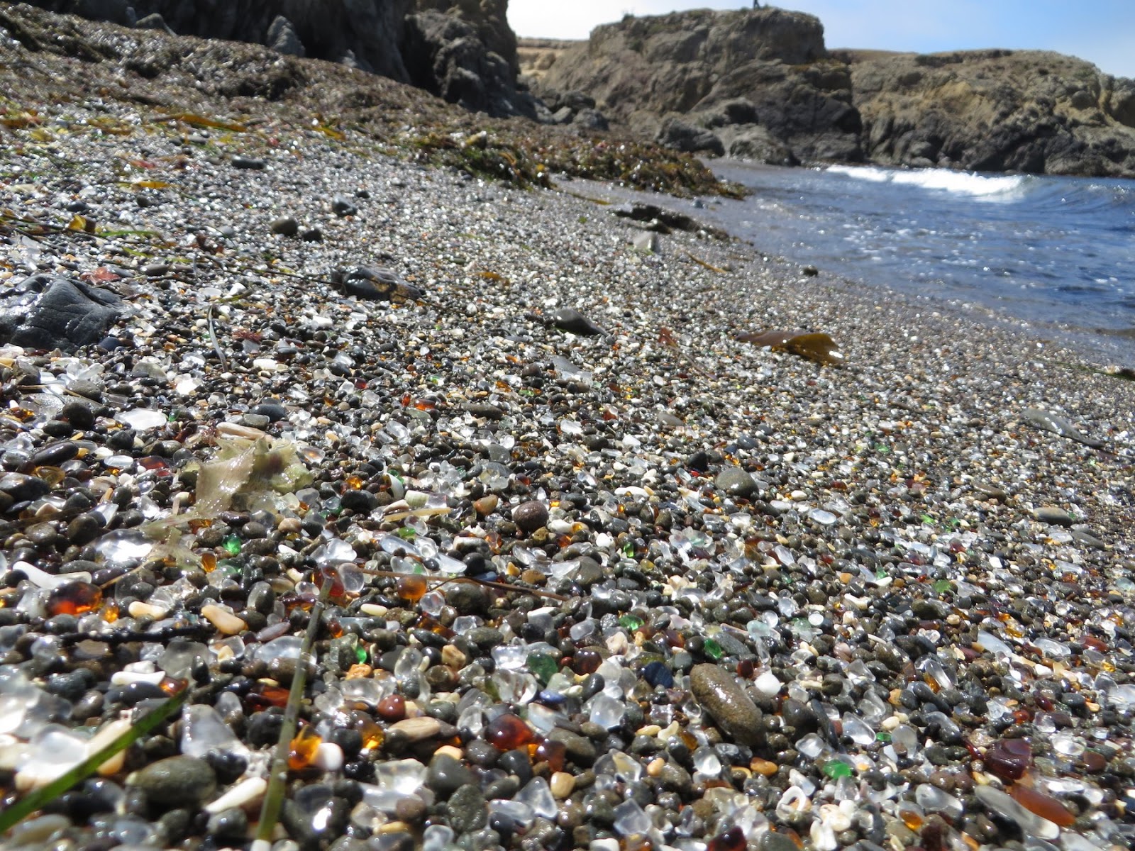
It was nice to have a full day at MacKerricher to check out the area.  In the middle of the day, we drove south for coffee in Fort Bragg (Headlands) and lunch in Mendocino (Good Life Cafe).  We found our way out to Glass Beach - a neat little industrial relic and about the only place in Fort Bragg where you can get to the beach since most of the town's waterfront consists of hundreds of acres of an old Georgia Pacific mill site surrounded by chain link fence (when this finally gets redeveloped, it will sure change the character of this area - for better and worse, I suppose).


MacKerricher


Lunch in Eureka, then our winding ride through Petrolia and Honeydew, took awhile. I had hoped to check out Shelter Cove, but by the time we finally got to the main road, we realized it might be better to just keep going. We grabbed sandwich stuff for dinner at a grocery store, which M ate right away, but I waited until we until we got back to the coast to eat mine (Route 1 between Leggett and the coast is not one for eating and driving at the same time). We got to the coast right around sunset, which was great, and eventually pulled into our reserved spot at MacKerricher around 9 in the evening.


MacKerricher is just north of Fort Bragg and was our base for two nights.  Our campsite turned out to be pretty close to the beach, which was nice, and we could listen to the surf in the distance at night (not that there was much surf during our visit).


Saturday, July 05, 2014

Cape Mendocino


We turned off 101 to go to Ferndale, then took the Mattole Road south and back out to the coast.  I figured we'd spend the whole afternoon on very windy roads before getting back to the highway - which is exactly what happened.  But what an incredible route!

I had been afraid for weeks that this section would be fogged in, but we got lucky. On the other hand, just before we lost cell coverage, one of M's friends texted us about a possible 8.0 in the Aleutians.  I had visions of the tsunami washing us off the road south of Cape Mendocino until I thought about it a little more and realized it was more likely to drown us in the campground later that night.  As it turned out, a big wave never materialized.

Cape Mendocino was spectacular and we had it almost to ourselves - this road discourages tourist traffic.  I spent a great 30 minutes wandering the beach at the mouth of the Mattole River (M seems to like the views and the opportunity to read more than walking on the beach while I take thousands of pictures).  We stopped, as I suspect most tourists through here do, when we saw the zebras sharing pasture with the horses near Petrolia.


Eureka


We've had a good routine this trip - breakfast and dinner at the campsite - but then fun lunches prepared by someone with more skill and imagination and ingredients. With some careful searching and filtering, the internet is a great way to find places you might otherwise miss. Our trips have become a nice blend of old-fashioned discovery and high-tech reconnaissance. Or is it the other way around?

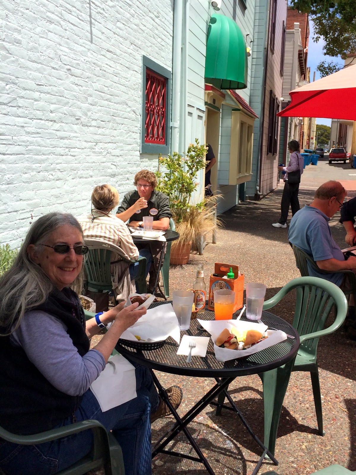
We had lunch at Cafe Nooner on Opera Alley in Eureka's Old Town, where I had an oyster Po' Boy and M had some sort of falafel-stuffed flatbread. Both were very good. We walked over to Living the Dream on the waterfront for ice cream. Normally, I eat the ice cream and M resists, but this time none of the flavors really did it for me and we swapped roles.