Wednesday, September 19, 2012
Duluth
Two years ago, we passed through Duluth on our way east on Route 2 (Duluth: June 2009). It was fogbound and we didn't stay very long. This time, the weather was better and we had reservations at the upscale Canal Park Lodge right on the lake.
Duluth almost got wiped out by an amazing rainstorm in June of this year -- but down on the lake we saw little evidence of it.
Labels:
minnesota,
SeptTrip2012,
vacation
Location:
Duluth MN
Naniboujou Lodge
If I hadn't accidentally found this place while I was exploring our route with Google Earth and Panoramio prior to the trip, we would have just driven right on by. As it was, we not only got a chance to check out a fantastic piece of idiosyncratic architecture and history, but got a great lunch, too!
Labels:
minnesota,
SeptTrip2012,
vacation
Location:
Naniboujou Lodge
Lake Superior
Our route from Seattle to Minnesota was largely beach-free so the detour east to Thunder Bay was intentional - we needed some sort of coastline to give us a break from days of prairie.
The weather was nice for traveling, but the off and on overcast made the photography a challenge at times. It was also a fairly quick tour - most of the my stops were short with M and D lingering in the car on their iPhones while I ran down to the beach and took a few pictures. D joined me to skip rocks a couple of times and we all took the short hike down to Sugarloaf Cove, where D tried to teach M new Frisbee throws while I - you guessed it - took pictures of the beach.
Labels:
minnesota,
SeptTrip2012,
vacation
Location:
Lake Superior
Pigeon River
The Pigeon River marks the Minnesota - Ontario border for a few tens of miles before it enters Lake Superior. It was a significant route inland from the Great Lakes for those folks trying to get their canoes and pelts back and forth from the west. But first they had to portage some significant waterfalls where the river makes the final plunge to lake level. This is the high falls - just a mile or so inland from Lake Superior.
Labels:
minnesota,
ontario,
SeptTrip2012,
vacation
Location:
Pigeon River
Friday, September 14, 2012
Thunder Bay
Thunder Bay marked the eastern end of our slightly circuitous trip to Minnesota. As usual, I was up early and drove out to Chippewa Park south of town and then to Marina Park in the north part of the city. The lake was remarkably calm on this beautiful morning. Despite this being the largest of all lakes, Thunder Bay is still a bay and its horizon is marked by the "Sleeping Giant" on the Sibley Peninsula.
Eventually, I retrieved M and D, we checked out, and then drove up to Mount McKay for an overview of the city. Then it was off for the border and a return to the U.S.
Labels:
canada,
ontario,
SeptTrip2012,
vacation
Kakabeka Falls
The Kaministiquia River flows east into Lake Superior at Thunder Bay. 20 miles west of the city and conveniently near the highway, it plunges 130' over Kakabeka Falls. We pulled in just at sunset for a brief sightseeing stop at the tail end of a very long day of driving.
Labels:
canada,
ontario,
SeptTrip2012,
vacation
Western Ontario
You don't have to drive through western Ontario to get from Winnipeg to southern Minnesota, but it helped satisfy my need for geographic variety and completeness.
About 30 miles east of Winnipeg - near Steinbach - the flat, largely treeless prairies end (we're almost 900 miles from the Rockies) and the Canadian Shield begins. The land starts to rise and the cultivated fields turn to forest. It's another few tens of miles before you begin to see bedrock along the roadside. And then it's hills and forest and ancient rocks all the way east - although this trip we only went as far as Thunder Bay.
Somewhere between Dryden and Thunder Bay we crossed into the eastern time zone and a little farther on we left the Hudson Bay watershed and entered the St. Lawrence drainage. I love crossing these continent-scale divides. The so-called Great Divide (the Rocky Mountain crest which divides east and west flowing rivers) is just the most prominent continental divide in North America, but there are many others. Like this one in Ontario. Later this trip M and I drove west past a Continental Divide sign on I-94 in North Dakota between Valley City (Sheyenne River - Red River - Nelson River - Hudson Bay) and Jamestown (James River - Missouri - Mississippi - Gulf of Mexico).
Another piece of geographic trivia. When you drive across Canada, you enter Ontario west of Minneapolis and Des Moines. You leave it at the same longitude as New York City. That's one wide province!
Labels:
canada,
ontario,
SeptTrip2012,
vacation
Location:
Western Ontario
Winnipeg
M and I were just here in Winnipeg a year ago and now we're back. I guess it's sort of on the great circle route between Seattle and Northfield. Last year, we spent an hour or two at the Forks, eating lunch and walking along the river. This time we spent the night and I was out early the next morning on D's bike checking out the river and the bridges. Last year, the Red River was still recovering from the floods of the previous year, but the evidence of those is fading quickly.
Labels:
canada,
manitoba,
SeptTrip2012,
vacation
Location:
Winnipeg, Manitoba
Cypress Hills
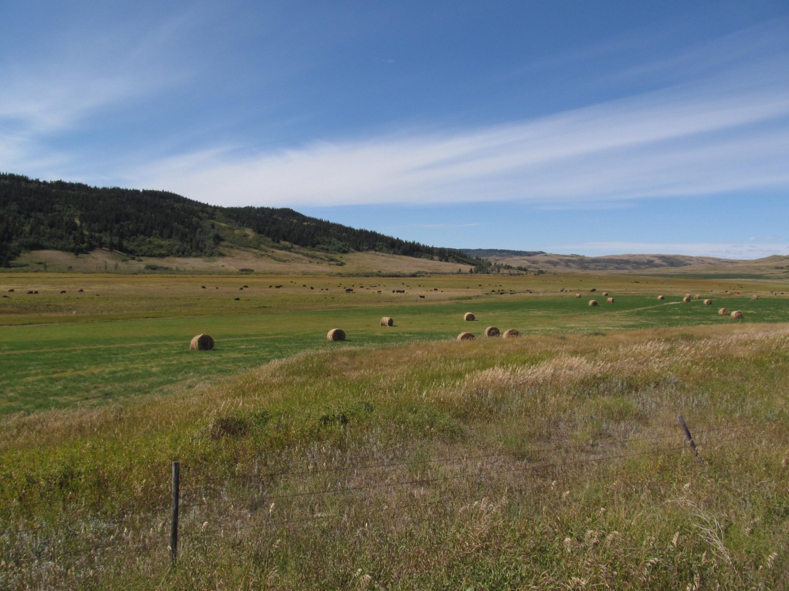
The prairies are powerful places for me - thanks, I suppose, to long family driving trips as a kid and a fair amount of time spent living in oil towns in these wide open grasslands that fan east from the Rockies. As much as I love the Rockies, it was reaching the prairie east of Crows Nest Pass yesterday afternoon that moved me the most. Endless rolling late season wheat fields back lit by the low sun helped, too.
The Cypress Hills are a small remnant of an earlier higher prairie - one long since removed elsewhere by meandering rivers flowing east. Its height left it perched above the glaciers, so the partially forested surface is an extremely old one in this part of the world where most landscapes are young (if 12,000 years is young). One of these photos shows how flat the upper surface remains - the very fact that it is higher than its surroundings means that there are few streams to erode it, except at its margins (and there, only slowly).
I find these little bits of high country surrounded by prairie enchanting. Riding Mountain National Park in Manitoba. The Turtle Mountains on the North Dakota-Canada border. The Rockies are full of small mountain ranges surrounded by high sage steppe, but these are lower, more remote from the mountains, and much more subtle.
These were important places for First Nations peoples. They harbored game, provided water and refuge, offered timber for shelter and firewood. They were strategic landmarks. They were often the sites of skirmishes as settlers moved into the region. They have also shaped western literature and sensibilities. Wallace Stegner lived south of here and wrote Wolf Willow about that time.
Labels:
alberta,
canada,
saskatchewan,
SeptTrip2012,
vacation
Location:
Cypress Hills
Lethbridge
The railroad spans the 300' deep canyon on a mile-long steel trestle built in 1909 - one of the longest and highest in the world. The valley is mainly park space with a wonderful network of trails.
Labels:
alberta,
canada,
SeptTrip2012,
vacation
Location:
Lethbridge, Alberta
Sunday, September 09, 2012
Castlegar
For the second time this summer, I'm heading east to Minnesota in the new (but increasingly less so) Subaru. This time, M is along and D will be with us for the first half of the trip. We will leave him and his bike and his stuff in Minnesota in a week. The first trip, in late May and early June, is documented in 24 posts at RoadTrip2012.
M and D claim to enjoy these expeditions, and even support longer variations, but are pretty much useless when I ask for input on routes or places of interest. Which is okay, since it lets me pursue quirky destinations that would be difficult to make a convincing public argument for. Like wanting to see the Columbia River north of the border, the big coal mines on the west side of the Crows Nest Pass, the railroad trestle in Lethbridge, the Cypress Hills, and the north shore of Lake Superior.
Saturday we drove over the North Cascades Highway on a beautiful day and worked our way across Route 20 to Omak and Republic and (almost) to Kettle Falls. We drove up the Columbia, past the junction with the Evans Cutoff from Colville, where I spent a night sleeping in a pasture amidst cow pies on my month-long pre-college walkabout in August 1976.
Castlegar is where the Kootenai (sometimes Kootenay) River joins the Columbia. It's easy to forget that the Columbia and its Canadian tributaries drain much of the west side of the Canadian Rockies, not just the interior northwest of the U.S. Early Sunday morning, I tried different ways of getting down to the water's edge at the confluence - succeeding below Selkirk College on the east side and at Zuckerberg Island on the west (the island is on the Castlegar side and is not named after Mark Z of Facebook fame).
The river flows freely here, but dams are everywhere up and down stream and flood control has left its mark in the form of cobble banks now heavily overgrown with trees.
AERIAL VIEW
Labels:
british columbia,
canada,
SeptTrip2012,
vacation
Location:
Castlegar, BC, Canada
Subscribe to:
Posts (Atom)